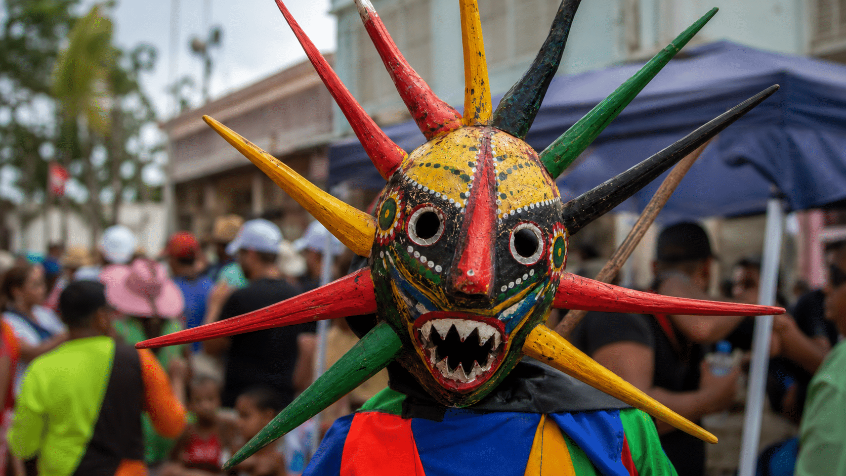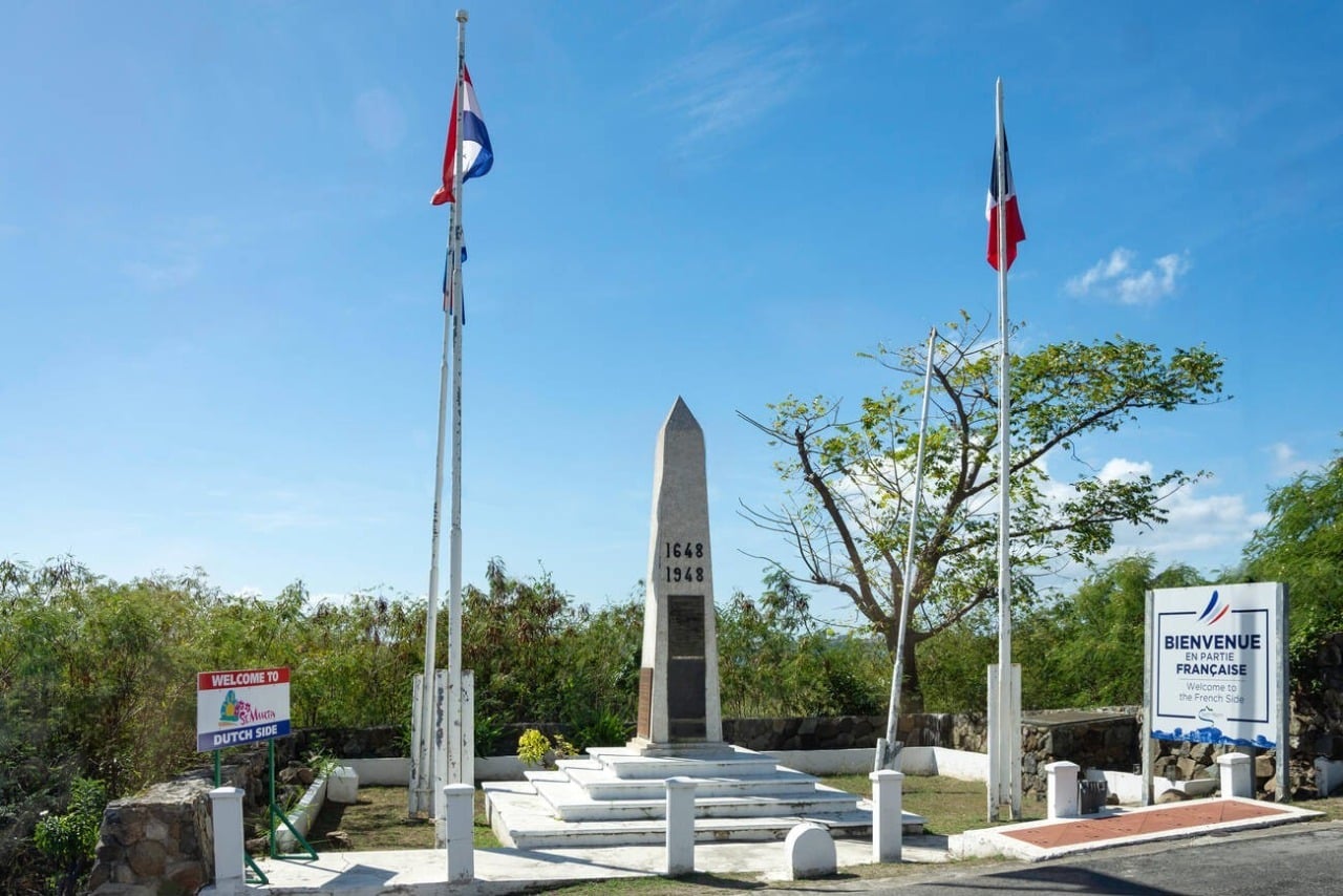
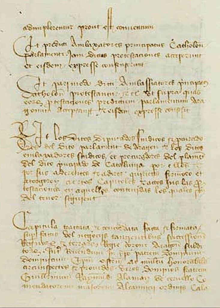
March 23, 1648 occupies a special place in Caribbean history. On that day, the French and Dutch signed the Concordia Treaty an agreement organizing the division of the island of Saint-Martin. More than three centuries later, this particularity remains one of the Caribbean’s most striking historical facts: the same island, two administrations, a land border that has become one of the region’s most singular.
A strategic island at the heart of European rivalries
Before it was divided, Saint-Martin was a coveted island. Its position in the north of the Lesser Antilles made it an important foothold, but it was above all its natural saltworks that attracted Europeans in the 17th century. At the time, salt was an essential resource for preserving foodstuffs, and thus a major economic issue. The Spanish, French and Dutch followed in their footsteps. In 1633, Spain imposed its control over the island to secure its maritime routes in the region. This domination was limited in time, and came to an end on the eve of the partition of 1648.
At this point, both the French and the Dutch were present on the island, but neither could claim total control. The situation imposed a strategic choice: find an agreement rather than engage in confrontation.
March 23, 1648: an agreement to structure the territory
The Concordia Treaty, signed on March 23, 1648, marked a decisive turning point. The French and Dutch decided to divide the island into two distinct administrative zones. The agreement laid the foundations for a lasting organization: each power would administer a part of the territory, while maintaining the possibility of circulation and trade. This choice contrasts with the logic of total conquest prevailing at the time. The division was thus based on a particular balance: a clear political separation, but a territory that continued to be experienced as a common space.
A border born of lasting compromise
From the outset, the Saint-Martin border has been part of a logic of coexistence. It did not result in a total break between the two parts of the island. Over time, the boundary was clarified and framed, particularly in the early 19th century, without calling into question the principle established in 1648. This gradual evolution explains the stability of the division over time. Even today, the border is characterized by a high degree of fluidity in everyday use. It directly reflects the spirit of the Concordia Treaty, based on balance rather than strict separation.


Two systems, one shared island reality
The legacy of the Concordia Treaty is still visible in the island’s current organization. To the north, the French collectivity of Saint-Martin. To the south, Sint Maarten, a constituent country of the Kingdom of the Netherlands. Two political frameworks, two administrative systems, two legal organizations coexist on the same territory. Yet everyday practices go far beyond this division. Travel, economic activities and social relations are organized on an island-wide scale, well beyond the border. This reality makes Saint-Martin a rare case in the Caribbean.


378 years later, a legacy that continues to shape the future
March 23, 2026 marks the 378th anniversary of the Concordia Treaty. This date remains central to understanding how the island is organized today. The partition of 1648 had a lasting influence on the island’s political, economic and social balance. It also shaped a particular way of living in a shared territory. In the Caribbean context, Saint-Martin stands out for this historical construction, the result of a compromise that continues to shape the island’s day-to-day operations.
Understanding Saint-Martin through the Concordia Treaty
The Concordia Treaty was more than just an agreement signed in the 17th century. It was the starting point for a territorial organization that is still in place today. Saint-Martin is neither a division nor a juxtaposition of two territories. The island functions as a shared space, structured by two sovereignties that have coexisted for over three centuries. To understand March 23, 1648 is therefore to understand the origin of this Caribbean singularity, still visible today in every aspect of life on the island.
The island of Saint-Martin has been divided into two territories since March 23, 1648, when the Concordia Treaty was signed between France and the United Provinces. After the departure of the Spanish, both powers were present on the island, but neither was able to take full control. Rather than clash, they decided to share the territory. The result was a French part to the north and a Dutch part to the south, an organization that still exists today.
The border between Saint-Martin (French part) and Sint Maarten (Dutch part) is characterized by its fluidity on a day-to-day basis. It separates two political and administrative systems, but remains easy to cross for everyday purposes. Inhabitants regularly move between the two sides of the island to work, shop or access certain services. This situation directly reflects the legacy of the partition established in 1648.
The Concordia Treaty played a decisive role in the history of Saint-Martin, organizing its official division between the French and the Dutch. Signed in 1648, it laid the foundations for a lasting territorial division, while enabling the two parties to coexist. This agreement structured the island’s political organization over the long term and continues to influence the way it operates today, making Saint-Martin a unique territory in the Caribbean.