
Kaieteur Falls: A single 226-meter drop in Guyana.

Kaieteur Falls

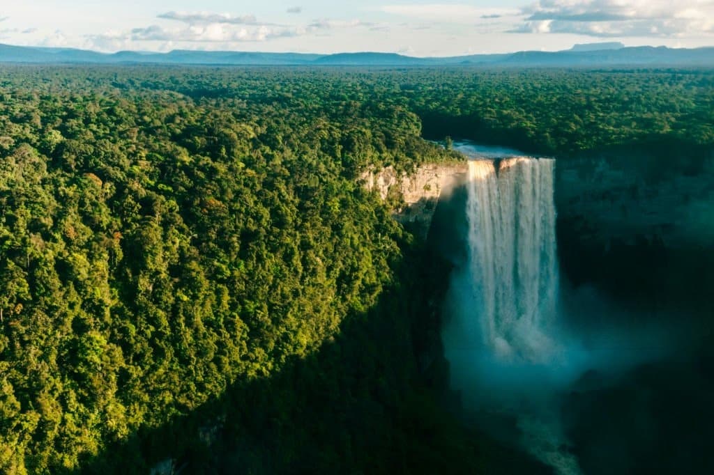
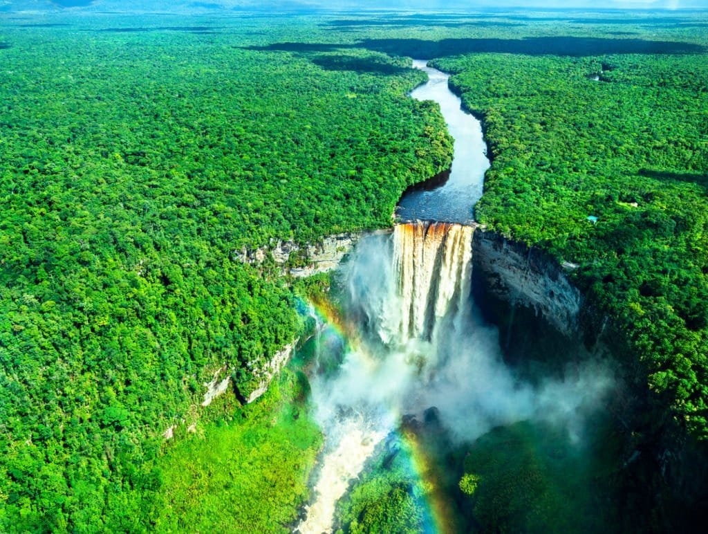
As the plane leaves Georgetown, the roads fade from view, the houses become tiny, and the forest eventually fills almost the entire horizon. Then, suddenly, a white break appears in this vast expanse of green. These are the Kaieteur Falls, where the Potaro River plunges 226 meters in a single drop. The sight is impressive not only for its height but especially for its surroundings: almost no man-made structures, just rock, forest, water, and open space.

Kaieteur Falls

Kaieteur Falls: 226 meters that put things into perspective

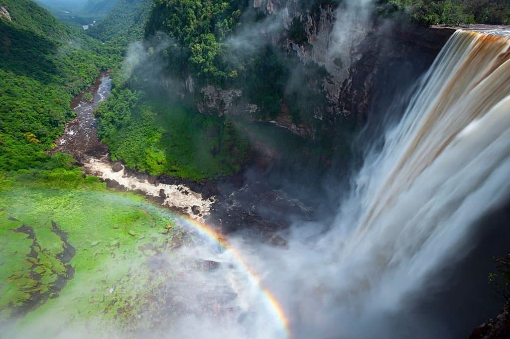
At 226 meters, or 741 feet, Kaieteur Falls is more than four times as high as Niagara Falls. Its uniqueness also lies in the combination of this height and the volume of water plunging from the plateau. Here, the Potaro River does not cascade down in a series of waterfalls. It flows through the landscape, suddenly reaches the escarpment, and then vanishes into a curtain of water, spray, and roaring sound.

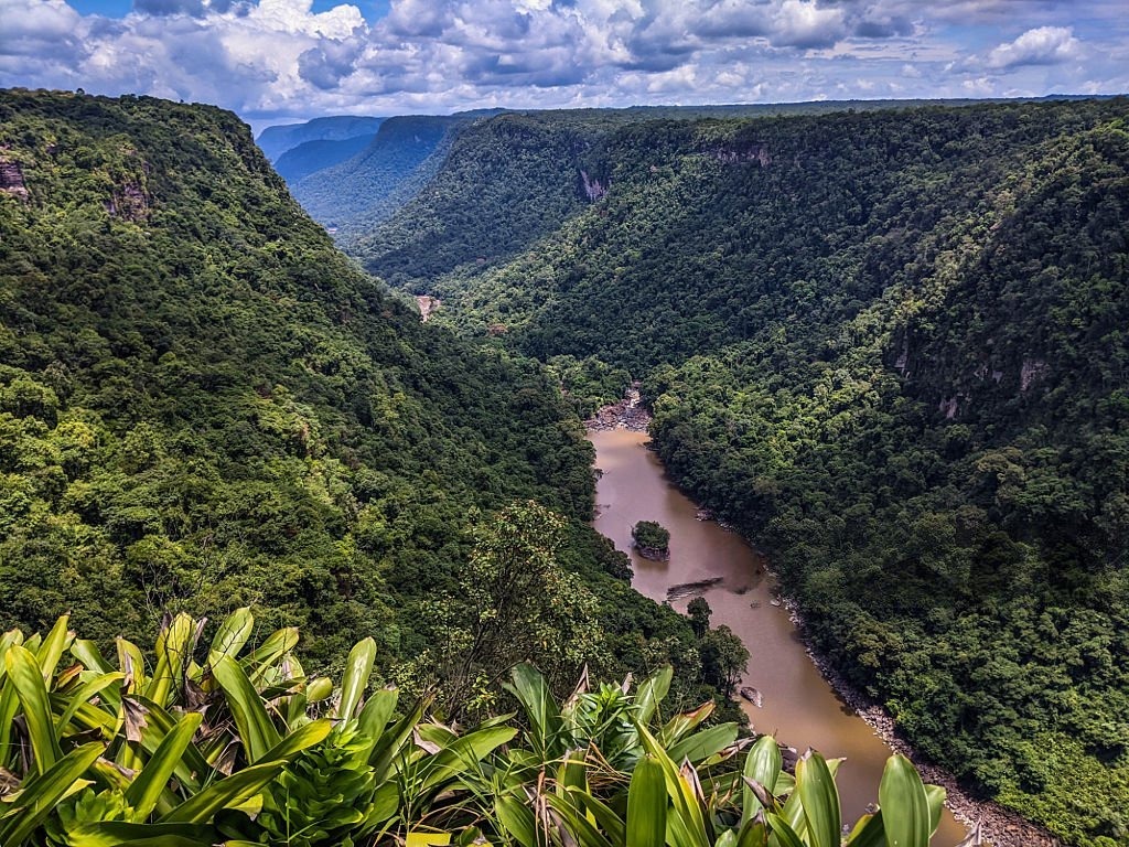
This power gives the place a feeling that is difficult to capture in a photograph. From the viewing points, the eye is not drawn solely to the waterfall. It also takes in the rock faces, the mist rising from the pool, and the expanse of forest that seems to stretch on endlessly.

Kaieteur Falls
Kaieteur Falls
Kaieteur Falls
Kaieteur Falls

A waterfall in the heart of a landscape billions of years old

Kaieteur Falls are located in the Potaro-Siparuni region, within Kaieteur National Park. Established in 1929, the park now covers approximately 62,700 hectares. It lies on the Guiana Shield, a geological formation whose rocks are over two billion years old in some places.

This geological depth adds another dimension to the site. Kaieteur is not just a spectacular destination—it’s also a window into one of the oldest landscapes on the South American continent. In this part of Guyana, the tourist experience relies less on a series of activities than on coming face-to-face with the sheer scale of the landscape.

Kaieteur Falls
Kaieteur Falls

A place filled with stories

Long before the first Western accounts, Kaieteur Falls were known to the region’s Indigenous peoples, particularly the Patamona. Several oral traditions are associated with their name. One tells of a chief who chose to cross the falls in a canoe to protect his people. Another tells of an old man who was swept away by the waters. These stories should not be confused with established historical facts. Their significance lies elsewhere: they serve as a reminder that the place is also part of a cultural memory, and not just part of the history of tourism or exploration.

On April 29, 1870, British geologist Charles Barrington Brown reached the falls during an expedition. This date marks its entry into Western exploration history, but not its “discovery” in the strictest sense: local communities had known about Kaieteur for much longer.

A Living World to Explore Up Close

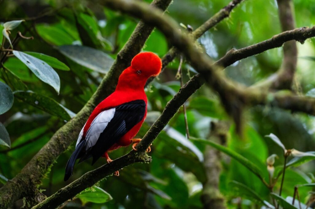
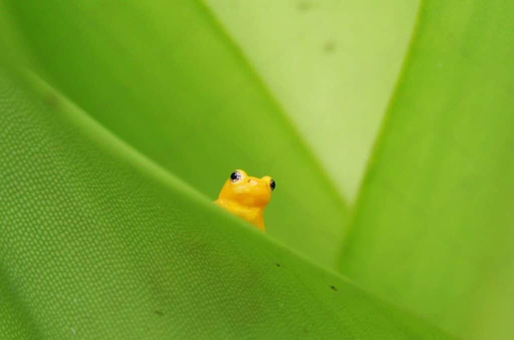
Around Kaieteur Falls, the spectacular can be found in just a few centimeters. The park is home to Anomaloglossus beebei, a small golden frog endemic to the area. It lives in close association with large bromeliads, whose leaves retain small reserves of water used for the development of tadpoles. Visitors can also spot the orange rock cock and Kaieteur swifts, which nest in the cliffs near the waterfall. This biodiversity serves as a reminder that the waterfall is not just an isolated attraction: it is the most visible part of a much larger ecosystem.

Kaieteur Falls
Kaieteur Falls

The experience of seeing Kaieteur Falls begins even before you arrive

For many visitors, the journey to Kaieteur Falls is part of the experience. Flights from Ogle Airport in Georgetown take about an hour. From the small planes, the urban landscape gradually gives way to rivers, then to the forest. Upon arrival, guided trails lead to several viewing points, including Rainbow View, Boy Scout View, and Johnson View. Each offers a different perspective: from one vantage point, the falls appear massive; from another, they seem almost suspended above the valley.

Perhaps that is where Kaieteur’s true strength lies. Its 226 meters are impressive, but they tell only part of the story. Kaieteur also reveals a Guyana that is forested, ancient, indigenous, and deeply connected to its wild landscapes. It is a destination that demands not only to be admired, but to be understood within the context of the land that gives it its full power.

Kaieteur Falls are located in Guyana, in the Potaro-Siparuni region, in the heart of Kaieteur National Park. They are formed by the Potaro River, in a vast tropical rainforest setting.

Kaieteur Falls is approximately 226 meters, or 741 feet, during their main jump. The Potaro River plunges almost straight down from the plateau, creating the impressive waterfall that can be seen today.

Kaieteur Falls are notable for their combination of height, powerful flow, and secluded forest setting. The site also has significant cultural importance, linked to indigenous traditions, and is home to remarkable biodiversity.

Leave a Reply

Your email address will not be published. Required fields are marked *

More articles from RK

Soup joumou, soupe de giraumon haïtienne préparée pour le 1er janvier
CULINARY ART
Tolotra

Soup joumou, the only Caribbean dish recognized by UNESCO

In Haiti, soup joumou is the soup prepared every January 1, the country’s Independence Day. Made with pumpkin, beef, and vegetables, it became the only Caribbean dish inscribed on UNESCO’s Intangible Cultural Heritage list in 2021. However, the narrative linking it directly to the independence of 1804 remains, even today, a point of debate among some Haitian historians. A soup made before dawn In many Haitian households, preparations for soup joumou begin on the evening of December 31, so that it will be ready when everyone wakes up on January 1. The giraumon, a winter squash with orange flesh, is peeled and boiled before being pureed to form the base of the broth. Beef, short pasta, and chopped vegetables, carrots, leeks, celery, cabbage, are then added. This tradition, repeated every New Year’s Eve in kitchens across Haiti and throughout the Haitian diaspora, ushers in a day that Haitians directly associate

Read More »
Skatta Burrell, Jamaican producer of the Coolie Dance riddim, at an event
MUSIC
Tolotra

“Coolie Dance”: Skatta Burrell’s Jamaican riddim, 22 years later

In 2003, in a studio in Kingston, producer Cordel “Skatta” Burrell put together a riddim for a few dancehall tracks. Twenty-two years later, that same riddim entered the Billboard Hot 100 Top 10 for the second time, this time propelled by Colombian star Karol G. “Coolie Dance” tells the story of how a sound created in Kingston continues to set the pace for global pop music, far beyond the island where it was born. This week, “Bby WOW,” Karol G ’s song featuring Judeline and Rusowsky, climbed from No. 16 to No. 10 on the Billboard Hot 100. The song is already topping the Spotify Global 50 and the Billboard Hot Latin charts, with more than 78 million streams since its release in late summer. The previous week, the track had already peaked at number one on the Billboard Global 200, the global chart that spans all platforms. Around the

Read More »
Heritage Days
NEWS
Tolotra

What if Heritage Days started right around the corner from your home?

To celebrate Heritage Days 2026, Richès Karayib, in collaboration with Martinique’s Directorate of Cultural Affairs (DAC), invites everyone to explore the island’s historic monuments using its interactive heritage map.You don’t always have to travel across Martinique to make a discovery.Just a few blocks from home, there may be a church whose history you’re unaware of. Along a road you travel every week, an old house may tell the story of several centuries of economic and social change. A public building, a market, a distillery, or the remains of an industrial site may be part of our protected heritage without those who pass by them every day even realizing it.That is precisely what the European Heritage Days remind us of every year: heritage isn’t just what we visit. It’s also what surrounds us. Heritage Days—Start with Your Local Community For the 2026 European Heritage Days, the interactive map developed by Richès

Read More »

conTACT RK

we'd love to have your feedback on your experience so far

Join The List

Join our Richès Karayib community!  Sign up for our newsletter.

Want To Maximize Your Business Presence On Riches Karayib?

Complete the form to start the application