
Bonaire welcomed 13,387 overnight visitors in June 2026, according to preliminary data from the Tourism Corporation Bonaire. Visitor numbers declined slightly by 1.6% year-over-year. The most revealing information, however, lies in the travelers’ countries of origin: the Netherlands, the United States, and Curaçao together accounted for 85.5% of arrivals.
Bonaire's visitor numbers remain close to 2025 levels
In June 2026, the island welcomed 13,387 visitors, compared with 13,606 a year earlier. The difference amounts to 219 fewer arrivals. This variation remains limited, especially when viewed over a longer period: by June 2025, attendance had increased by 12,2 % compared to June 2024. The 2026 figure therefore reflects more of a stabilization following the sharp increase recorded the previous year. The 1.6% decline provides a useful point of comparison, while trends in the major markets offer a more accurate picture of visitor numbers.


Three markets bring 11,445 visitors to Bonaire
The Netherlands remains the top source country with 5,389 visitors, or 40.3% of the total. The United States follows with 4,163 arrivals, accounting for 31.1%. Curaçao ranks third with 1,893 visitors, or 14.1%. Combined, these three markets account for 11,445 people, or 85.5% of the visitors recorded in June. This percentage, calculated by Richès Karayib based on data published by TCB, reveals a high geographical concentration of visitor traffic.
However, this concentration has decreased slightly. In June 2025, those same three markets accounted for 11,904 of the 13,606 visitors, or approximately 87.5% of the total. Their combined share has thus declined by two percentage points in one year, leaving more room for visitors from other regions. This structure connects the island to three distinct regions: the Netherlands, its main European market; the United States, its leading North American market; and Curaçao, its Caribbean neighbor. Bonaire’s tourism industry is thus based on long-haul connections and clearly visible regional mobility.


The balance of power is shifting between the Netherlands and the United States
A comparison with June 2025 offers a different perspective. The number of Dutch visitors rose from 5,207 to 5,389, representing an increase of approximately 3,5 %. Their share of total arrivals rose from 38.7% to 40.3%. At the same time, the number of American visitors fell from 4,732 to 4,163, a decline of approximately 12 %. Their share fell from 34.8% to 31.1%. Curaçao remained relatively stable, with 1,893 visitors compared with 1,965 a year earlier.
The overall trend therefore masks differing trajectories. The Dutch market is growing, while the U.S. market is experiencing a more pronounced decline. The available data do not specify the causes. The coming months will reveal whether this is a lasting trend or a one-time deviation.

In Bonaire, two markets are having very different experiences
Scuba diving is a major draw for American travelers
Among American visitors, 48.5% say they are visiting for vacation, and 40.3% for scuba diving. The close relationship between these two motivations underscores the special role that underwater activities play in the island’s appeal to this demographic. Their choice of accommodations is also highly concentrated: 58.6% choose hotels, followed by villas at 11.6%. The main U.S. states of origin are Florida, Texas, California, Pennsylvania, and North Carolina.
The Dutch are diversifying their vacations even further
Among Dutch travelers, vacations clearly dominate, accounting for 70 percent. Visits to family or friends account for 10.4%, while business trips account for 6.8%. Hotels remain the top choice, at 51.3%, but apartments account for 13% and staying with a relative accounts for 11%. These proportions reflect a more diverse use of the island, ranging from traditional tourism to personal visits and business travel.


Curaçao Maintains the Regional Focus of Tourism in Bonaire
With 14.1% of arrivals, Curaçao adds a regional dimension to visitor numbers that are largely driven by Europe and North America. Travel within the Dutch-speaking Caribbean accounts for a significant portion of the total, although TCB does not provide details on the motivations of these travelers. For Bonaire, the June data thus provide a more comprehensive picture than a simple monthly total. They show a destination driven by three markets, but visited for different reasons. The results for July and the following months will help determine whether this concentration—as well as the decline in American visitors—persists.
Bonaire welcomed 13,387 overnight visitors in June 2026, according to preliminary figures released by the Bonaire Tourism Corporation. This represents a 1.6% decrease from the 13,606 visitors recorded in June 2025.
The Netherlands is the leading market with 5,389 visitors, followed by the United States with 4,163 visitors and Curaçao with 1,893 visitors. Together, these three markets account for approximately 85.5% of arrivals in June 2026.
Vacation is their primary motivation, accounting for 48.5% of responses. Scuba diving comes in a close second at 40.3%, confirming its particular importance in Bonaire’s appeal to the U.S. market.
To the northwest of Saint Kitts, the walls of Brimstone Hill Fortress overlook the coast from a volcanic hill nearly 240 meters high. Behind the panoramic view lies a more complex history: that of a fortress designed by the British, built and maintained by enslaved Africans, and designated a UNESCO World Heritage Site in 1999.
Brimstone Hill Fortress, a citadel perched atop a volcano
As you climb Brimstone Hill, the sea comes into view between the steep slopes and the dark stone ramparts. From this natural vantage point, soldiers could observe the western coast of Saint Kitts and keep watch for the possible arrival of enemy ships. The location was far from insignificant. This volcanic hill, nearly 800 feet high, had steep, hard-to-access slopes. It thus offered a prime vantage point and a defensive refuge in the event of a naval attack. Nevertheless, the builders had to adapt their techniques to the particularly challenging terrain.
The walls were built primarily from volcanic rock quarried from the hill. The mortar was made on site from limestone found on the hill’s middle and lower slopes. The fortress thus seems to be an extension of the landscape on which it stands.

1690: The Start of a Project That Would Last More Than a Century
The construction of Brimstone Hill Fortress began in 1690. That year, the British set up cannons on the hilltop in order to recapture Fort Charles from the French. The site was then gradually expanded, in successive phases, until the 1790s. This construction project, spanning more than a century, attests to the strategic importance of Saint-Christophe, now known as Saint Kitts. The English and French established a permanent presence on the island in the 17th century and shared control of it between 1627 and 1713. Saint Kitts thus became one of the first footholds for their colonial ambitions in the region.
At that time, the Caribbean territories were generating considerable wealth for the European powers. The ports, plantations, and shipping routes had to be protected. Given its scale, Brimstone Hill was a testament both to British military power and to the economic value placed on the island.


British architecture, a project imposed on Africans
The fortress’s architecture met the requirements of British military engineers. Yet the people who transported the materials, quarried the rock, and built the walls were primarily enslaved Africans. This reality lies at the heart of the historical value recognized by UNESCO. Brimstone Hill Fortress It is not only a remarkable example of 17th- and 18th-century military architecture; it also bears witness to European colonial expansion, the transatlantic slave trade, and the emergence of new societies in the Caribbean.
To present the site as merely a British feat would therefore overlook an essential part of its history. Its architecture is also the result of the strength, skill, and endurance of enslaved workers, who were subjected to particularly harsh conditions on the steep slopes.

Fort George, the defensive heart of the fortress
At the summit stands Fort George, the monumental heart of the complex. Built on one of the two highest points, it comprised barracks, storage areas, artillery positions, and spaces arranged around a central courtyard. Fort George is one of the oldest surviving British examples of a so-called “polygonal” fortification system. Unlike forts dominated by large, projecting bastions, this design better conformed to the terrain and provided multiple defensive angles. Several restored rooms now house a museum dedicated to the site’s history.
A large cistern built beneath one of the rooms was used to collect and store water. According to the ICOMOS assessment, it was still being used as the park’s main water source at the time of the UNESCO nomination review.

From Military Use to World Heritage Site
After several generations of occupation, British troops left the fortress in 1853. The complex gradually lost its military function, and several buildings fell into ruin. A restoration movement took shape in the 20th century. The Society for the Restoration of Brimstone Hill was founded in 1965. Now known as the Brimstone Hill Fortress National Park Society, it manages the park on behalf of the government and the people of Saint Kitts and Nevis.
In 1999, UNESCO inscribed the site on the World Heritage List under criteria III and IV. The protected area covers 15.37 hectares and remains one of the best-preserved historic fortified complexes in the Americas.

Brimstone Hill Fortress: A Memory to Face Head-On
From the ramparts, the landscape can make you forget, for a moment, the violence of history. Yet every wall serves as a reminder of colonial conflicts, rivalry between empires, and the forced labor that made the site’s construction possible. Preserve Brimstone Hill Fortress…it means preserving much more than just a former military outpost. It means passing on a heritage that showcases, all at once, the architectural ingenuity, the European ambitions, and the experiences of the Africans who built the fortress. This leaves one crucial question: How can we admire such a monument without separating its beauty from the lives sacrificed to build it?
Brimstone Hill Fortress is located in the northwest of the island of Saint Kitts, in the country of Saint Kitts and Nevis. The fortress overlooks the coast from a steep volcanic hill.
Brimstone Hill Fortress has been a UNESCO World Heritage Site since 1999. The site is recognized for its remarkable British military architecture and for its role in documenting colonization, the transatlantic slave trade, and the labor of enslaved Africans.
Brimstone Hill Fortress was designed by British military engineers. Its construction and maintenance relied primarily on forced labor provided by enslaved Africans between the late 17th century and the 18th century.
For the first time, Curaçao welcomed more than 400,000 overnight tourists during the first six months of a year. Between January and June 2026, the island recorded 437,086 visitors, a 9% increase compared to the same period in 2025. This is a historic figure. But it doesn’t yet tell the whole story: how can this growth create more value for residents, local businesses, and the island?

Curaçao Reaches a New Milestone
The month of June confirmed this trend. The island welcomed 62,867 overnight visitors, compared with 57,413 a year earlier. These arrivals generated 497,426 overnight stays, up 12%, while the average length of stay reached 7.9 nights. This detail is important. A destination doesn’t just benefit when it attracts more travelers. It benefits most when those visitors stay longer, shop at local businesses, dine at restaurants, choose local activities, and spend their money beyond the major tourist complexes.
In June, 54% of travelers stayed in hotels or resorts, compared with 46% who stayed in alternative accommodations. This near-parity shows that tourism Curaçao is no longer limited to traditional housing providers. It opens up opportunities for smaller providers, but also raises questions about short-term rentals and access to housing.


Markets that don't experience the island in the same way
The Netherlands remains the top source market for tourism. In June, 20,029 Dutch visitors stayed on the island, a 22% increase from the previous year. Their average length of stay was 12.1 nights, significantly longer than that of American or Colombian visitors. The United States ranked second with 16,070 arrivals, despite a 6% decline. According to the Curaçao Tourist Board, this temporary decline is believed to be linked in part to residents who traveled to follow the national team during the World Cup. Some of the available airline seats were reportedly used for departures from the island during that time.
Colombia, for its part, continues to gain momentum, with 7,144 visitors in June—a 24% increase. This growth underscores the geographic proximity of Curaçao along with South America and the growing role of Latin American markets.


A more diverse audience
For the first half of the year as a whole, the Netherlands accounted for 31% of arrivals, ahead of the United States at 27%. Canada and Colombia each accounted for 7%, Brazil for 5%, and Argentina for 4%. This diversification reduces dependence on a single source of travelers. It also requires tourism stakeholders to adapt flight routes, the languages used, cultural offerings, and the services provided. For the island, therefore, the challenge is no longer simply to attract more tourists. It is to better understand their profiles, their travel habits, and their actual contribution to the local economy.

A record alone is not enough to measure success
Tourism supports the hospitality industry, restaurants, transportation, and numerous services. But a rapid increase in visitor numbers also leads to greater demand for water, energy, transportation, housing, and waste management. This is where the record takes on a different nature. It becomes an indicator of success, but also a test of capacity. An island can welcome more visitors while undermining its ecological balance if infrastructure, skilled jobs, and local resources do not keep pace.
The real added value will therefore be seen elsewhere: in the number of jobs created, the portion of spending that stays in the local economy, the growth of local businesses, and the preservation of cultural heritage.


Beyond the Numbers: The Question of the Model
The first half of 2026 confirms Curaçao’s international appeal. Markets are diversifying, overnight stays are on the rise, and the average length of stay is increasing. But the next key indicator may not be a new record for arrivals. We will need to assess what this growth actually means for residents. Welcoming 437,086 visitors in six months is a historic achievement. Turning this visitor traffic into a sustainable driver of growth for Curaçao would be an even greater success.
Curaçao welcomed 437,086 overnight visitors between January and June 2026. This represents a 9% increase compared to the same period in 2025 and is the best first half-year for tourism the island has ever recorded.
The Netherlands remains Curaçao’s largest market, followed by the United States. Canada, Colombia, Brazil, and Argentina are also contributing to tourism growth, reflecting a gradual diversification of visitors.
This growth supports the hospitality, restaurant, and transportation sectors, as well as many local businesses. However, it also increases the demand for housing, water, energy, transportation, and waste management. The main challenge, therefore, is to turn this record growth into sustainable benefits for residents and the local economy.
Founded in 1511, Baracoa was Cuba’s first colonial city. Yet it wasn’t until December 1965 that it gained a modern road connection to the rest of the country. The 454 years between these two dates tell the story of a geography that protected, slowed, and profoundly shaped the identity of the “Ciudad Primada.”
A road suspended between the mountain and the precipice
On La Farola, the drive never feels like just an entry into the city. The road clings to the slopes of the Sagua-Baracoa mountain range, winds through a series of curves, and overlooks valleys covered in vegetation. For drivers, every turn serves as a reminder of the same fact: reaching Baracoa by land was long a challenge.
The city is located at the eastern tip of Cuba, between the Atlantic Ocean and a mountainous range that is difficult to cross. This location has given it spectacular scenery, but it has also limited overland travel for centuries. Baracoa was not cut off from the world: the sea, trails, and local trade maintained connections. However, it lacked a continuous road network comparable to those in the rest of the island.


1511: Cuba's first city
Diego Velázquez founded Nuestra Señora de la Asunción de Baracoa in 1511. Official Cuban sources describe it as Cuba’s first town, first capital, and first episcopal see. It also retains its original location, another unique feature among the island’s earliest Spanish settlements.
This status might have led one to imagine a city that would quickly become a hub of national trade. History took a different turn. After colonial power shifted to other cities, Baracoa remained isolated behind its mountains. Its coastal presence remained essential, while its hinterland developed its own agricultural, dietary, and cultural practices.
This relative isolation helped, in particular, to strengthen the role of cacao and coconut in the local economy. Even today, these crops are closely associated with Baracoa, right down to its recipes and rural landscapes.

36 kilometers built in 20 months
The transition began in April 1964. Construction on the La Farola Viaduct began to create a road through the mountain range. The project spanned 36 kilometers and was completed in December 1965, after twenty months of work. Construction crews are facing steep slopes, ravines, heavy rains, and landslides. Some operations are carried out on steep slopes, with limited space for heavy equipment. The challenge, therefore, is not just to build a road, but to maintain a stable course through a wet and rugged mountain.
In 1997, La Farola was named one of the seven wonders of Cuban civil engineering. This recognition captures its technical significance, but not its full human significance. The road finally established a regular land connection between Baracoa, Guantánamo, and the rest of the country. It facilitates the movement of people, goods, and services, without negating the constraints of the terrain.


Biodiversity that also explains isolation
The mountains surrounding Baracoa are not merely an obstacle. They are part of one of the most remarkable natural areas in the Caribbean. The Cuchillas del Toa Biosphere Reserve covers 208,305 hectares, including 6,013 hectares of marine area. UNESCO has identified 928 endemic species there. These figures offer a different perspective on La Farola. The road crosses a region whose inaccessibility has likely helped preserve exceptional ecosystems. While opening up the area has made Baracoa more accessible, it has also raised a long-term question: How can we improve mobility without compromising what makes the region unique?


What 454 Years Have Left Behind in Baracoa
La Farola has changed Baracoa’s relationship with Cuba, but it has not turned the city into just another tourist destination. Its architecture, agricultural traditions, relationship with the sea, and mountainous surroundings still bear the marks of a history shaped far from the major thoroughfares.
Perhaps that is the real takeaway. Baracoa didn’t just wait for a road for 454 years. During that time, it developed an identity strong enough to survive its opening to the outside world. Sixty years after La Farola, the challenge is no longer simply to reach the city. It is to figure out how to better connect it without diminishing the unique character that its isolation helped shape. This has become a central issue for its cultural and environmental future.
Baracoa is considered Cuba’s first colonial city, as it was founded in 1511 under the name Nuestra Señora de la Asunción de Baracoa. It was also the island’s first capital and one of its earliest administrative and religious centers. However, its location between the Atlantic Ocean and the mountains of eastern Cuba limited its development by land for several centuries.
La Farola is a mountain road built between 1964 and 1965 to connect Baracoa to the rest of Guantánamo Province and Cuba. Approximately 36 kilometers long, it winds through rugged terrain marked by ravines, steep slopes, and heavy rainfall. Its opening put an end to Baracoa’s long-standing isolation from the rest of the country and facilitated the movement of people, services, and goods.
Baracoa offers insight into how centuries of isolation have shaped a unique local identity. The city is particularly known for its cacao, coconuts, historic architecture, and mountainous surroundings. Travelers can also explore La Farola, take in the views dominated by El Yunque, and discover a region near the Cuchillas del Toa Biosphere Reserve.
When you arrive in Saint-Barthélemy, the first thing you see as you disembark is the name of the capital: Gustavia. Not Sainte-Anne, not Saint-Jean, not a French name. Gustavia. This name marks the beginning of one of the Caribbean’s most unique colonial chapters: that of a French island that became Swedish for nearly a century.
A small island long considered unprofitable
With an area of 21 square kilometers and a population of 10,660 according to INSEE’s reference population figures as of January 1, 2023, Saint-Barthélemy has a multi-layered history. Christopher Columbus was the first known European navigator to report sighting the island in 1493, during his second voyage. He named it after his brother Bartolomeo.
The French established a permanent settlement there in 1648. Philippe de Longvilliers de Poincy, lieutenant general of the American Islands, sent Jacques Gante there with 52 men. Conditions were difficult. There was a shortage of fresh water, and the limited land available prevented the development of a large-scale sugar industry comparable to that of the neighboring islands. The inhabitants primarily cultivated cassava, yams, indigo, and tobacco, while also engaging in fishing and livestock farming.
However, this economy was not immune to the Caribbean slave system. The 1671 census already attests to the presence of enslaved Black men, women, and children, who were employed alongside free residents.


Saint-Barthélemy comes under Swedish sovereignty
The turning point came on July 1, 1784. The France of Louis XVI and the Sweden of Gustav III signed an agreement transferring the island to the Swedish kingdom. In exchange, France obtained trade privileges in the port of Gothenburg. The transfer took effect in March 1785, with the arrival of the Swedish governor Salomon von Rajalin.
The town of Carénage was then renamed Gustavia, in honor of King Gustav III. On September 7, 1785, it was granted free port status. The economic landscape changed rapidly: thanks to its neutrality and strategic regional location, the port welcomed ships from several powers involved in the conflicts in the Atlantic. The island was briefly occupied by the British from 1801 to 1802, before being returned to Sweden.


Around 1800, Saint-Barthélemy had a population of about 6,000, including nearly 5,000 in Gustavia. Stone and wooden buildings lined the streets, while Forts Gustaf, Karl, and Oscar protected the harbor. French and English were the dominant languages in everyday communication. Swedish remained primarily associated with the administration and a community of immigrants from the kingdom, which, according to the local museum, never exceeded 127 people at any one time.
But this prosperity was also built on slavery. As early as 1787, Swedish authorities enacted legislation governing enslaved people, and enslaved workers helped build Gustavia. Slavery was not abolished until October 9, 1847.

From Commercial Decline to a Return to France
Beginning in the 1820s, trade in Gustavia began to decline. The end of major European conflicts reduced the importance of the neutral port. Droughts, hurricanes, and epidemics further worsened the situation. On March 2, 1852, a fire destroyed 135 houses and much of southern Gustavia.
By the end of the 19th century, the administration of the island had become an increasing burden for Stockholm. A local referendum was held in 1877: of the 351 votes cast, 350 supported a return to France. On March 16, 1878, the Swedish flag was lowered, and Saint-Barthélemy officially became part of France once again.
A Swedish legacy that remains visible to this day
This period has not disappeared from the landscape. The name Gustavia, the forts, certain buildings, and several urban landmarks still serve as reminders of Swedish rule. The main archival collection from this period is now held at the National Overseas Archives in Aix-en-Provence, while the SweCarCol university project has digitized a significant portion of it.
The island subsequently underwent further institutional changes. Following the 2003 referendum, it left the departmental and regional framework of Guadeloupe in 2007 to become an overseas collectivity. Since 2012, it has been an overseas country and territory associated with the European Union, while retaining the euro.
Today, with its focus on luxury tourism, Saint-Barthélemy also stands as a testament to a history where trade, sovereignty, slavery, and urban memory intersect. Behind the name Gustavia, how many visitors still grasp the full story this capital city tells?


Saint-Barthélemy came under Swedish sovereignty following a treaty signed in 1784 between the France of Louis XVI and the Sweden of Gustav III. In exchange for the island, France secured trade privileges in the port of Gothenburg. The transfer took effect in March 1785. For Sweden, this possession served as a commercial foothold in the Caribbean.
Saint-Barthélemy remained under Swedish sovereignty from 1784 to 1878—nearly a century. Swedish administration took effect in 1785, while the official return to France occurred on March 16, 1878. A referendum held in 1877 had overwhelmingly approved this return.
The capital of Saint Barthélemy is named Gustavia in honor of King Gustav III of Sweden. Under Swedish rule, the former Carénage was transformed into a free port and became an important regional commercial center. The name Gustavia, the Gustaf, Karl, and Oscar forts, and several other urban landmarks still serve as reminders of this period.
In Andros, the water doesn’t just surround the island—it opens it up. With 178 documented blue holes on land, at least 50 at sea, and 162 km² protected by the Blue Holes National Park, this Bahamian island tells its story through its depths as much as through its shores.
An island cut through by water
On Andros, the landscape may seem simple at first glance. Pine trees, mangroves, quiet roads, scattered villages, and the clear waters of the Bahamas. But beneath this tranquil surface, the island hides something else: a network of blue holes—deep water openings that lead to caves and underground passages.
So when visitors arrive near Captain Bill’s Blue Hole, they aren’t just looking at a round pool surrounded by trees. They’re looking at a gateway. Beneath it, the water tells a story older than the beaches—a story of limestone, rain, rising seas, and caves that filled up after the last ice age.

178 blue holes on land, at least 50 at sea
The number is staggering: Andros has 178 documented blue holes on land and at least 50 at sea. This is the highest known concentration in the Bahamas. It is a geological signature. Blue holes form in limestone. Freshwater dissolves the rock, opens fissures, widens passages, and eventually creates cavities. When sea levels rise, some caves fill with water. From the surface, sometimes all that remains is a dark circle. Beneath it lies a vertical world.
The island is the largest in the Bahamas and also one of the most mysterious. Its true architecture isn’t always visible from the road. Part of the island lies beneath our feet, beneath the roots, and beneath the water.
A 162-square-kilometer park to protect the deep sea
In 2002, Blue Holes National Park was established on North Andros. It covers 40,000 acres, or approximately 162 km². This scale matters. It shows that the blue holes are not treated as mere isolated curiosities, but as a natural system that must be protected. The park protects several blue holes, freshwater reservoirs, and pine and coppice forests. It is also home to 22 inland blue holes considered to be unique. Around them, trees, birds, insects, and groundwater all contribute to a delicate balance.
At Captain Bill’s Blue Hole, the depth exceeds 30 meters. A walkway, a gazebo, and a designated access point allow visitors to approach the site. But the experience isn’t limited to jumping into the water. This place serves as a reminder that every blue hole is fragile. The upper layer may be soft, the water denser at depth, and the chemical balance depends on what falls into it.


Worlds We Can't See from the Beach
Andros’s value lies precisely in what is not immediately apparent. In some blue holes, fresh water and saltwater meet. Between the two, a unique zone traps leaves, organic debris, and bacteria. Rare species or those adapted to these conditions can live there, sometimes in very confined spaces.
This gives Andros a richness that differs from the classic image of the Bahamas. Here, beauty isn’t limited to the horizontal blue of the sea. It extends downward. It plunges deep. It compels us to think of the Bahamas as an archipelago of cavities, water reservoirs, hidden ecosystems, and geological memories.
This natural wealth remains vulnerable. Blue holes have sometimes been used as dumping grounds. This action may seem harmless when viewed from the surface, but it can disrupt a very delicate balance. A bottle, a tire, or pollutants don’t just end up in a water hole—they enter a living system.


Andros, the Other Hidden Gem of the Bahamas
The island attracts visitors with its ocean, fishing, diving, and the tranquility of its natural landscapes. But its greatest draw may lie elsewhere: beneath its surface lies an exceptional concentration of gateways to the underground world.
That’s what makes Andros unique. Its blue holes are not mere attractions. They tell the story of an island shaped by water, protected by science, and inhabited by subtle balances. At a time when destinations often seek to showcase what glitters, Andros poses a deeper question: what is a place worth when its greatest treasure lies beneath the surface?


Andros is known for its exceptional concentration of blue holes—water-filled cavities that open up in the limestone. The island has 178 documented blue holes on land and at least 50 in the sea. This unique feature sets Andros apart in the Bahamas, as much of its natural identity lies beneath the surface.
Blue Holes National Park is located in North Andros, in the Bahamas. Established in 2002, it covers 40,000 acres, or approximately 162 km². The park protects several blue holes, freshwater reservoirs, pine forests, coppice areas, and fragile groundwater-dependent ecosystems.
The blue holes offer a different perspective on Andros—one that goes beyond that of a mere beach destination. They tell the story of an island shaped by water, limestone, and changes in sea level. They also reveal hidden ecosystems, fragile balances, and a different side of the Bahamas—one that is more scientific, more geological, and more unique.
Starting with the 2026–2027 season, Saint Lucia will join the Arsenal family as an official destination partner. This partnership places a Caribbean island at the heart of a strategy aimed at transforming global soccer into tourism, a source of pride, and opportunities for its youth.
A Partnership Formalized in Castries
In Castries, the Saint Lucia Tourism Authority formalized a multi-year global partnership with Arsenal Football Club. The London-based club will now serve as an ambassador for this Eastern Caribbean island, which has a population of approximately 180,500.
This choice is no small matter. Saint Lucia is seeking to raise awareness of its beauty, culture, and tourism offerings among an international audience. The United Kingdom plays a key role in this strategy, as it is one of the island’s main tourism markets. Arsenal serves as a gateway to millions of fans, matches watched in many countries, and platforms capable of spreading the island’s image far and wide. For an island destination, this visibility can make all the difference.


Saint Lucia, a showcase at the heart of English soccer
The partnership provides for Saint Lucia’s presence within the Arsenal ecosystem. In particular, the island will gain visibility at Emirates Stadium during Premier League, Women’s Super League, and cup matches. It will also be featured on the club’s digital platforms and channels.
Today, tourism is no longer limited to trade shows or traditional advertising campaigns. It also plays out through collective emotions. A game, a jersey, a video, a community of fans—these are places of memory, conversation, and sometimes the desire to travel. St. Lucia is therefore positioning its image where attention already exists to spread awareness of its name, its “Let Her Inspire You” campaign, and its identity among an audience that may know Arsenal before it knows the Pitons.
Saint Lucia Looks Back on Its Youth
The most interesting part of the agreement lies far from the stands. The partnership is also intended to support the creation of an Academy Hub in Saint Lucia. The stated goal is to create mentoring opportunities and development pathways to help young players develop their talent.
On many islands, sports serve as a common language. They embody children’s dreams, families’ efforts, makeshift fields, local clubs, and coaches who volunteer their time. When an international partnership promises opportunities for young people, it deserves careful consideration. The challenge will be simple to articulate but harder to measure: Can this global visibility produce real results on the ground? For young players in Saint Lucia, the Academy Hub will be the one to watch.


A destination with a story to tell
The island is often described as the only country in the world named after a woman. It is known for the Pitons, aUNESCO World Heritage Site, as well as for its forests, beaches, mud baths at Sulphur Springs Park, its chocolate-making heritage, and its major cultural events.
The Gros Islet Friday Night Street Party, the Saint Lucia Jazz & Arts Festival, the Lucian Carnival, and Creole Heritage Month already give the island a packed calendar of events. The partnership with Arsenal therefore builds on an existing legacy. The involvement of Julien Alfred, Olympic champion and tourism ambassador, further reinforces this perspective. Saint Lucia already knows that sports can project a name far beyond its borders. With Arsenal, the island is simply taking things to a whole new level.
Sports Tourism as a Strategy
This isn’t the first time the Saint Lucia Tourism Authority has partnered with big names in sports. The organization has previously collaborated with the New York Yankees, the Toronto Raptors, the Toronto Maple Leafs, and the Brooklyn Nets. The agreement with Arsenal is therefore part of a broader strategy focused on sports tourism.
Soccer, cricket, rugby, swimming: Saint Lucia wants to attract teams, athletes, visitors, and attention. For a Caribbean island, this strategy can become a powerful tool if it remains rooted in the local community. Visibility alone is not enough. It must fuel the local economy, events, young talent, and cultural recognition. That is where this partnership will truly be judged—not just by the size of the screens or the number of fans reached, but by what it leaves behind on the island.


When an Island Enters the Global Arena
With Arsenal, Saint Lucia is entering a space where sports, tourism, and identity intersect. Soccer becomes a showcase. The island becomes a story. And its youth become a promise to watch. The question now is: to what extent can a small Caribbean island transform the power of a major club into tangible benefits for its people?
Saint Lucia will become Arsenal Football Club’s official destination partner starting with the 2026–2027 season. This multi-year partnership, led by the Saint Lucia Tourism Authority, is intended to boost the island’s international visibility, particularly in the United Kingdom, one of its key tourism markets. It also provides for Saint Lucia’s presence within the Arsenal environment, at Emirates Stadium, during men’s and women’s matches, as well as on the club’s digital platforms.
Saint Lucia is partnering with Arsenal to reach a global audience already passionate about soccer. The goal is to raise the island’s profile beyond traditional tourism campaigns by associating the destination with a club that has a following in many countries. This partnership also helps strengthen the “Let Her Inspire You” campaign and showcase Saint Lucia as a Caribbean destination known for its nature, culture, events, and sports tourism.
The Academy Hub planned for St. Lucia is intended to create mentoring opportunities and pathways to help young players develop their talent. This is one of the most important aspects of the partnership with Arsenal, as it goes beyond mere tourism promotion. The challenge will be to see how this collaboration can produce tangible results for young athletes, local clubs, and the development of soccer on the island.
A capital city with no residents
On official maps of the United Kingdom, the capital of Montserrat still bears a name: Plymouth. But in Plymouth, there are no longer any neighbors, no longer an open town hall, no longer a bustling harbor. The town has been within the exclusion zone since 1997. In some places, it is buried under several meters of volcanic deposits—ash, mud, and lahars. And yet it remains linked, both legally and symbolically, to the capital of this British Overseas Territory in the Eastern Caribbean.
The Awakening of Soufrière Hills
On July 18, 1995, after centuries of dormancy, the Soufrière Hills volcano erupted. The first phreatic eruption, consisting of steam and ash, took the people of Montserrat by surprise. No one was killed. But scientists at the Montserrat Volcano Observatory, established as an emergency measure, quickly realized that this episode would not be brief. On August 21, 1995, Plymouth, the island’s capital and economic hub, located just a few kilometers from the summit, was evacuated for the first time. The residents returned. Then left again. The cycle would last for years.
In local lore, its name retains a special resonance. It evokes at once an ancient capital, a tangible loss, and a testament to resilience. To speak of Plymouth, then, is not to gaze at a ruin from afar. It is to return to a place that continues to shape the memory of an entire island, despite the silence of its streets today.
The Day There Is No Turning Back
The turning point came on June 25, 1997. Pyroclastic flows raced down the volcano’s flanks. These avalanches of gas, rock, and ash can reach extreme temperatures and move at high speeds. Nineteen people died that day in the danger zones. It was the only directly fatal event of the crisis. But it was also the tipping point. In August 1997, new flows covered a large part of Plymouth. Not all the buildings disappeared. Some roofs and walls remained visible. But the capital became uninhabitable. It ceased to be a city of daily life and became a city at a standstill.


An island that has shifted northward
What makes Montserrat unique is a set of statistics. The island covers approximately 102 square kilometers. Before the eruption, it had a population of over 10,000. The 2023 census recorded 4,386 residents. Between these two realities lie departures to the United Kingdom, Antigua, North America, and other Caribbean territories. There are also abandoned homes, papers saved in too much of a hurry, and families who have learned to live elsewhere.
The southern two-thirds of the island remain subject to strict restrictions. The area around the volcano no longer has any ordinary homes. The north, on the other hand, is home to schools, government offices, businesses, and new infrastructure. Montserrat hasn’t just rebuilt itself. It has moved.


Brades Takes the Helm, Little Bay Looks to the Future
The government has set up its headquarters in Brades, in the north. This town serves as the de facto capital. A new airport, now known as John A. Osborne Airport, opened in 2005 in Gerald’s to replace the former W. H. Bramble Airport, which was lost within the exclusion zone. In Little Bay, new port and administrative facilities are creating another hub.
But Plymouth remains the name that lingers in the memory. This anomaly is not merely administrative. It shows that a capital city can leave its buildings behind without leaving the collective imagination of a people. For many Montserratians who have moved to the United Kingdom—to London, Manchester, or elsewhere—Plymouth remains a place close to their hearts.
Look without entering freely
Unsupervised access to Plymouth is prohibited. Guided tours are available, led by certified guides and with the necessary permits, from the hills or along certain controlled routes. You can see the old bell tower, facades weathered by deposits, and the bay where ships used to arrive. The silence is far from a simple attraction. It forces you to look at things differently.
The Soufrière Hills volcano is not dormant. Since 2010, it has been in a long period of calm, but it remains active and under surveillance. The Montserrat Volcano Observatory continues its work. This, too, is the strength of Montserrat: living with the volcano without reducing its history to disaster. Plymouth is now uninhabited, but it still poses a question. What becomes of a capital city when its people must leave, yet refuse to erase it?
Plymouth became a ghost town following the eruptions of the Soufrière Hills volcano, which began in 1995. The capital of Montserrat was gradually evacuated and then rendered uninhabitable by pyroclastic flows, ash, mud, and volcanic deposits. Much of the southern part of the island remains under restrictions today, and the city lies within the exclusion zone. This makes Plymouth a rare case in the Caribbean: a former capital still present in official memory, but devoid of daily life.
Unrestricted access to Plymouth is not permitted, as the city is located in Zone V, a volcanic hazard exclusion zone. However, certain guided tours are available with a certified guide, subject to strict safety conditions. Visitors can view the buried city, its partially visible buildings, and the landscapes scarred by the eruption, but the experience remains controlled. Plymouth is therefore not a typical tourist destination: it is a place of remembrance, vigilance, and respect.
Plymouth remains significant because it represents the former political, economic, and social heart of Montserrat. Even though government operations have moved to Brades and new projects are taking shape in Little Bay, Plymouth continues to preserve the island’s memory of the time before the eruption. For Montserratians who remained on the island as well as those who left for the United Kingdom, Antigua, or elsewhere, the buried town serves as a reminder of a collective loss, but also of a territory’s ability to rebuild itself without erasing its history.
A constraint that can become a value
The Caribbean is experiencing climate change directly, brutally and continuously. More intense cyclonic seasons, accelerated coastal erosion, fragile coral ecosystems, energy vulnerability: no island in the region has been totally spared. For a long time, this reality has been presented as a constraint for public budgets, for tourism operators and for economic models based on the classic spa industry.
The Travel Dreams 2026 report by Amadeus, however, suggests a possible turnaround. What was once perceived as a fragility can become a value proposition, as long as it is acknowledged and accurately portrayed. This is where the notion of visible sustainability becomes central.
What travellers say
The study first documents the scale of demand. Of the 6,000 travelers surveyed across six major global markets, 75% say that a hotel’s sustainability commitments are important in their booking decision. More than one in three, precisely 35%, consider them “very important”.
And this concern translates into willingness to pay. Travelers who place importance on this criterion say they are willing to spend an average of 11.7% more per night to stay in an establishment with serious sustainable practices. This represents around $29 more on a $250 room. Among Generation Z travelers, this willingness rises to 14.7%, or almost $37 more per night. Visible sustainability starts here: in a hotel’s ability to communicate why these practices are worth more.
One data point deserves particular attention for the Caribbean: sensitivity to sustainability varies greatly according to source markets. It reaches 93% of travelers surveyed in India and 85% in China, compared to 65% in the UK and Germany. For a region seeking to reduce its dependence on traditional markets, these discrepancies open up a strategic avenue to be handled with caution. These travelers won’t be satisfied with a generic discourse on nature. They’ll be looking for evidence, visible features, documented stories. For the Caribbean, visible sustainability can become a way of speaking to these audiences without denying its local roots.

What hotels do
On the supply side, Amadeus data show a widespread commitment among the hoteliers surveyed. Of the 500 general managers or equivalent profiles consulted across nine countries, all say they plan to spend on sustainability initiatives in the coming year. The average anticipated expenditure represents 6.7% of total company expenditure. And 35% of hoteliers identify sustainability as a key differentiating factor from their competitors.
But the study also highlights a revealing discrepancy. Hotels invest primarily in actions that have an internal operational efficiency rationale: water conservation (33%), sustainable catering supply (33%), responsible supply chains (33%), waste reduction (32%), staff training (32%).

On the other hand, practices that are more visible to the customer, such as renewable energies (28%), biodiversity and community initiatives (27%), and the link between sustainability and loyalty programs (21%), remain less developed. It is this tension that makes visible sustainability strategic: it forces us to move from internal effort to an experience understood by the traveler.
Closing the gap
Joerg Schuler, Head of Global Hospitality Sales at Amadeus, sums up this discrepancy by talking about sustainability as being more “visible, experiential and integrated into the stay”. The formula is important, because it changes the subject. It’s no longer just a question of saying that a hotel consumes less water or reduces its waste. It’s about making these choices understandable, concrete and experienced by the traveler. Visible sustainability therefore requires not only proof, but also an accurate narrative.

This gap is precisely what the Caribbean can bridge. Visible Caribbean sustainability is not an abstract technical program. It can be embodied in visible, relatable, situated practices. Restoring mangroves. Coral reef protection. Local solar energy. Short-distance sourcing from small island producers. Saving water in contexts where the resource is precious. Passing on traditional knowledge of how to use the environment sparingly.

Each of these practices can be both a serious environmental commitment and a story that travelers can experience during their stay. It is this articulation that transforms visible sustainability into perceived value, and thus into pricing leverage.
A value to be documented
A Caribbean hotel that can document, with figures, identified partners and measurable results, its role in restoring a local ecosystem is no longer just selling a room. It’s selling participation in a broader regional project. Travelers surveyed by Amadeus have already indicated their willingness to pay for this. Visible sustainability therefore requires showing what is being done, by whom, with what effects.

This logic goes beyond the individual hotel business. It also concerns destination management bodies, tourism authorities and regional economic players. A region’s ability to credibly communicate its ecological commitment is becoming a competitive variable in the face of other tropical destinations. At destination level, visible sustainability can become a common language for hotels, producers, associations, communities and travellers.

The Caribbean challenge
For the Caribbean, the challenge is not to become sustainable in the sense that other regions understand it. It is to make legible a sustainability that, in many cases, is already practiced at the level of communities, small businesses, local cooperatives and inherited know-how. The global market is willing to pay for it. The question is whether the region will be able to present this reality with the appropriate rigor, coherence and pride.

This series of articles, in its three parts, has attempted to defend the same thesis. The expectations of travelers in 2026 – disconnection, connection to place, visible sustainability – are not constraints that Caribbean players have to endure. They are expectations that the region structurally bears, by virtue of its geography, cultures and history. What remains, as always, is the patient task of putting them into words. This is the editorial mission that Richès Karayib will continue to carry out, alongside the region’s economic, institutional and creative players.
Visible sustainability refers to the set of sustainable commitments that a traveler can actually see, understand or experience during their stay. It’s not just about internal measures, such as reducing water costs or limiting waste behind the scenes. In the Caribbean, this can take the form of solar power clearly integrated into the hotel, a mangrove restoration program, coral reef protection, sourcing from local producers or community actions presented with concrete results. This approach makes the ecological commitment more legible and credible for the traveler.
Visible sustainability can become a competitive advantage as travelers increasingly value hotels’ environmental commitments. According to the data used in the article, a majority of travelers consider these commitments to be important when choosing an establishment, and a proportion are even willing to pay more for serious practices. For Caribbean hotels, the challenge is not only to act, but also to document and tell the story of these actions with precision. An establishment capable of demonstrating its local impact is no longer just selling a room: it is proposing participation in a local project.
Caribbean destinations can better promote their visible sustainability by linking the actions of hotels, producers, associations, local authorities and communities into a coherent narrative. This requires proof: figures, identified partners, measurable results, actions monitored over time. A destination that explains how it protects its reefs, saves water, supports short circuits or restores its ecosystems builds a stronger promise than a simple discourse on nature. For the Caribbean, this storytelling is strategic, as it transforms real climate vulnerability into a cultural, ecological and economic value proposition.
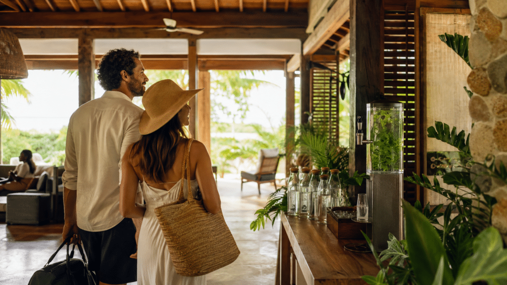
When luxury is more than just décor
For a long time, luxury in the international hotel industry was measured by the thickness of the marble, the height of the ceilings, the scarcity of objects in the rooms. Some of this grammar still exists. But another, potentially more profitable, is emerging. Cultural luxury is gaining in importance. It is measured by the quality of the connection a traveler can establish with the place he or she is visiting.
This evolution is documented in Travel Dreams 2026: From data to delight, a report published by Amadeus in April 2026, based on a survey conducted by Opinium Research in the fourth quarter of 2025. Asked about the sensations they seek in a destination, 24% of the 6,000 travelers cited “connection to a place: food, experiences, special moments”. This was the second most frequent response, behind freedom. As far as hoteliers are concerned, the figure is becoming strategic: 44% of the 500 general managers surveyed across nine countries identified “concierge and guided experiences” as one of the two main drivers of growth in non-room revenues, on a par with social events.
What travellers are really looking for
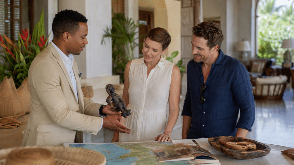
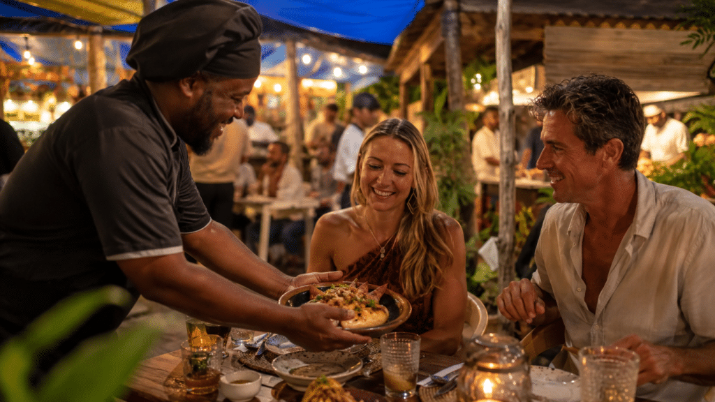
In other words, what travelers are looking for, and what hoteliers worldwide are beginning to monetize in earnest, is the same thing: access to living culture. Cultural luxury is not just about décor or service levels. It’s about creating the right relationship between the visitor, the area and the people who bring it to life.
The Amadeus report goes further, putting a figure on what it calls “local experience kits”: neighborhood guides, handcrafted souvenirs, connections with cultural players. It estimates that a mid-range hotel could generate over $243,000 in additional annual revenue from this type of service, based on a guide price of $20 per kit. Nearly a third of business travelers who extend their stay for leisure purposes say they are prepared to pay more than 15% above the average rate for this type of service. With this in mind, cultural luxury is also becoming an issue of business model, not just image.
The Caribbean's value is still under-structured
This fact is particularly relevant to the Caribbean. The region’s cultural heritage is alive and well, but still unevenly structured in terms of tourism and hotel offerings. The Kalinago traditions of Dominica, the Creole languages spoken from island to island, the memory of ancient maritime routes, syncretic ritual practices, culinary know-how handed down outside the formal circuits: all this constitutes a capital that still largely escapes the logics of standard hotel valorization. And yet, this is precisely where cultural luxury can find its most solid footing.

Exceptions do exist. Some independent hotels in the Caribbean have long understood that having a traveler dine in a local market, meet with an artisan or enjoy an hour’s silent walk in a heritage district creates a value that is difficult to compare with a standardized spa facility. But these initiatives often remain isolated, barely visible in destination communications, and rarely structured as a coherent economic proposition. To turn cultural luxury into a sustainable lever, we need to move on from one-off initiatives to a clear, profitable offering that respects local players.

Local experiences to be organized differently
The Amadeus report identifies a potentially game-changing trend. According to the study, 41% of hotels surveyed have already created packages linked to regional concerts, cultural events or popular TV series, and 38% plan to do so within the year. The traveler of 2026 no longer comes just to see a place. They come to enter into a relationship with it, through proposals that are constructed, told and embodied. This shift towards cultural luxury is exactly the kind of proposition that the Caribbean can articulate, provided its economic players work together.
This implies a number of shifts. Firstly, we need to move away from competition between islands and think in terms of pan-Caribbean offerings, where the richness of each territory complements rather than cannibalizes each other. Secondly, we need to professionalize the way in which our cultural heritage is presented: not by folklorizing it, but by presenting it with the editorial and visual rigor expected by a well-informed international traveler. Finally, we need to structure the economic relationship between hotels, local cultural players and experience operators, so that the value generated benefits the regions and not just international intermediation platforms. Caribbean cultural luxury can only be as strong as the people who bring it to life.

A journey that also promises personal transformation
Another statistic in the report is worth noting. Asked what they hope to bring back from a trip, 18% of travelers surveyed cite “a new version of themselves: clearer, lighter, more intentional”. This figure rises to 39% among travelers surveyed in China. For Caribbean destinations seeking to diversify their source markets, this signal deserves attention. It does not allow us to generalize to all Asian markets, but it does show that some travelers already associate travel with a form of personal transformation.

Enhancing without diluting
In 2026, cultural luxury is no longer sold in rooms alone. It’s sold in encounters. In hours. In presence. The Caribbean has what it takes to meet these expectations. All that remains is to organize it, to tell its story, to enhance its value without diluting it.
Cultural luxury is a new way of thinking about high-end travel. It’s not just about the comfort of a hotel, the quality of a room or the presence of exclusive amenities. It’s built around the relationship between the traveler and the territory visited. In tourism, this can take the form of a meeting with an artisan, a meal prepared with local produce, a guided tour by a local, or an experience that provides a better understanding of a place’s history, languages, practices and memories. Cultural luxury therefore gives value to that which cannot easily be copied: the living identity of a territory.
Cultural luxury represents a major opportunity for the Caribbean, as the region boasts a rich living heritage: Creole languages, culinary traditions, historical memories, music, craft skills, community practices and indigenous or Afro-descendant heritages. Yet some of this richness remains unstructured in conventional tourism offerings. By developing better-organized local experiences, Caribbean territories can create new revenue streams, boost the attractiveness of their destinations and better involve cultural players in the value generated by tourism. The challenge is not just economic: it also concerns the transmission, recognition and preservation of local identities.
Caribbean hotels can develop cultural luxury by working directly with local players: artisans, guides, chefs, artists, historians, cultural associations, heritage communities and experience operators. The aim is not to turn culture into décor, but to build respectful, rewarding and well-told propositions. This means choosing legitimate partners, presenting traditions accurately, avoiding clichés and guaranteeing that income actually benefits the people who carry this knowledge. A solid cultural luxury doesn’t put culture on display: it creates a fair encounter between the visitor, the place and those who bring it to life.