
Voltaire Falls: 70 km of trail to reach the waterfalls.

Chutes Voltaire

In Saint-Laurent-du-Maroni, the journey to the Voltaire Falls begins well before the first waterfall. From the town, the Paul Isnard Trail leads into the forest for about 70 kilometers. After being closed to the public for several years, the site has just reopened following a restoration program led by the Territorial Collectivity of French Guiana. The goal is threefold: to make the trail safer, to better accommodate visitors, and to showcase this natural site all without losing what gives this place its unique character.

70 kilometers before the trailhead

The figure illustrates the scale. The “Cascades et crique Voltaire” ZNIEFF, listed in the National Natural Heritage Inventory, begins at the end of the Paul Isnard trail, 70 kilometers south of Saint-Laurent-du-Maroni. The French Guiana Regional Nature Park also notes that you must take this road from the town before it turns into a dirt track.

Once you arrive, the journey continues on foot. The Chutes Voltaire trail is listed as 5.3 kilometers long and takes about three hours to walk. While this distance doesn’t make the place inaccessible, it does remind us of something obvious: here, the journey begins long before you reach the water. The trail, the forest, and the path are all part of the experience.

A Reopening Focused on Safety

The closure had brought the issue of access to the forefront. The renovation therefore had to address several areas. A comprehensive signage system has been installed starting from the town of Saint-Laurent-du-Maroni, particularly along the Paul Isnard Trail. A new visitor area now includes a parking lot, a parking space for people with disabilities, an access gate, and an information sign.

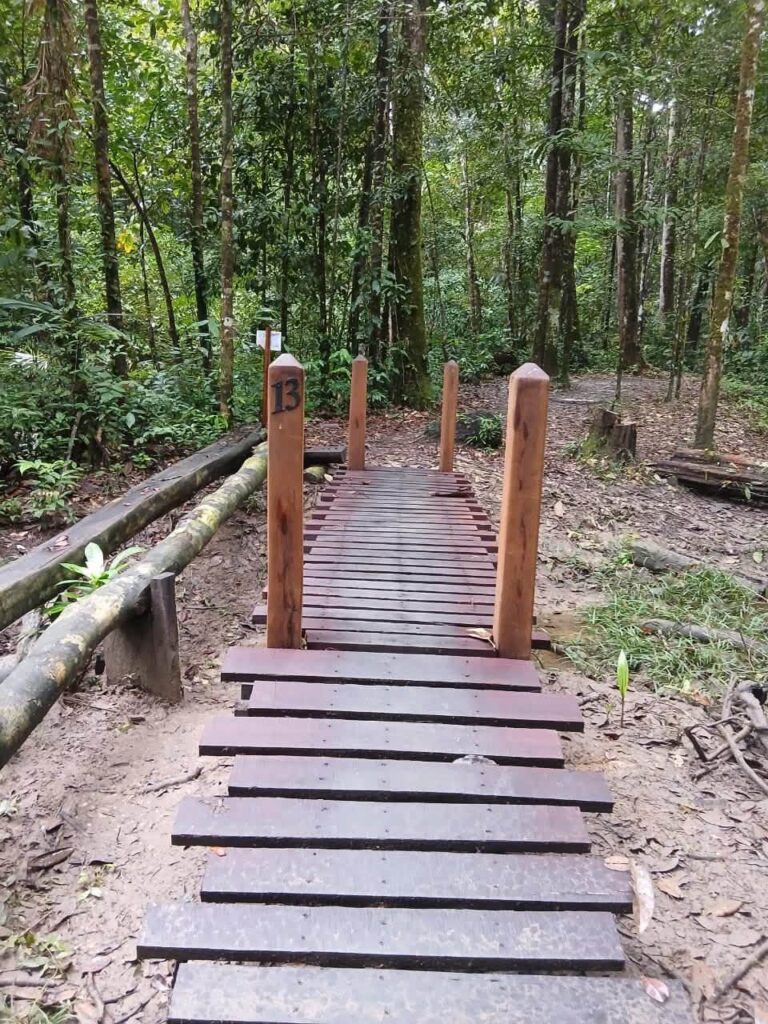
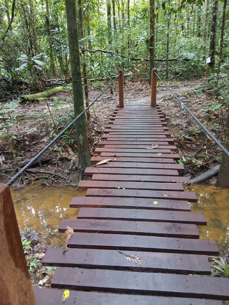
The most noticeable change is the reconstruction of the main footbridge. Approximately 21 meters long, it spans the Voltaire Creek. It was designed to better withstand flooding. The trail has also been restored, with several structures built to allow hikers to cross wetlands. According to information provided at the reopening, all of these improvements have received the necessary regulatory and technical approvals.

Voltaire Falls
Voltaire Falls
Voltaire Falls
Voltaire Falls

Voltaire Falls: A Landscape Unlike Any Other in French Guiana

The Voltaire Falls are not only notable for their remote location. It is a particularly rugged area, where the creek cuts through hard rock before reaching the waterfall zone. Over a distance of approximately 200 meters, the Voltaire Falls have a vertical drop of 35 meters, described in this official documentation as unparalleled in French Guiana. The site combines waterfalls, cascades, rocky thresholds, rapids, and forested areas. The area is recognized for its scenic, geomorphological, ecological, floristic, and faunistic features.

A multidisciplinary survey conducted in 2011 examined, among other things, the flora, fish, reptiles, amphibians, and non-flying mammals. This rich biodiversity serves as a reminder that opening the area to the public must also take into account a sensitive natural environment. The Voltaire Creek is part of the Maroni watershed and originates in a small mountain range east of the Sparouine Mountains. It flows for approximately 30 kilometers. In its upper reaches, the valley narrows and becomes winding: this is where the waterfalls are located. The terrain thus explains the spectacular appearance of the Voltaire Falls today.

Voltaire Falls
Voltaire Falls
Voltaire Falls
Voltaire Falls

At the foot of the waterfalls, a new kind of hospitality

The restoration doesn’t stop at the trail. At the base of the Voltaire Falls, visitors now have access to a large shelter, a fire pit, hammock shelters, and picnic tables with benches. These facilities are designed to provide a more comfortable rest stop after the hike. The reopening may also boost the appeal of western French Guiana as a tourist destination. The inn located at the site’s entrance is one of the local businesses likely to benefit from the return of visitors. This connection between natural heritage and the local economy adds another dimension to the work that has been done.

But the challenge won’t just be attracting more visitors. It will also be necessary to maintain a balance between visitor numbers, safety, and respect for the environment. At the Voltaire Falls, distance remains a key factor: 70 kilometers of road before the trail begins, followed by the forest and the creek leading to the waterfalls. The renovation makes the route safer and more comfortable. It doesn’t change the fact that it’s remote. And that may be precisely what makes the Voltaire Falls a unique destination in western French Guiana.

The Voltaire Falls are located in western French Guiana, south of Saint-Laurent-du-Maroni. They can be reached via the Paul Isnard trail, traveling about 70 kilometers before reaching the trailhead.

From Saint-Laurent-du-Maroni, take the road and then the Paul Isnard trail for about 70 kilometers. Once there, the journey continues on foot along a trail that is expected to take about three hours to complete.

The renovation of the Voltaire Falls is primarily aimed at making the trail safer and improving the visitor experience. The work includes new signage, visitor facilities, trail restoration, and a main footbridge approximately 21 meters long that spans the Voltaire Creek.

Leave a Reply

Your email address will not be published. Required fields are marked *

More articles from RK

Chutes Voltaire
TOURISM
Tolotra

Voltaire Falls: 70 km of trail to reach the waterfalls.

In Saint-Laurent-du-Maroni, the journey to the Voltaire Falls begins well before the first waterfall. From the town, the Paul Isnard Trail leads into the forest for about 70 kilometers. After being closed to the public for several years, the site has just reopened following a restoration program led by the Territorial Collectivity of French Guiana. The goal is threefold: to make the trail safer, to better accommodate visitors, and to showcase this natural site all without losing what gives this place its unique character. 70 kilometers before the trailhead The figure illustrates the scale. The “Cascades et crique Voltaire” ZNIEFF, listed in the National Natural Heritage Inventory, begins at the end of the Paul Isnard trail, 70 kilometers south of Saint-Laurent-du-Maroni. The French Guiana Regional Nature Park also notes that you must take this road from the town before it turns into a dirt track. Once you arrive, the journey

Read More »
Association des États de la Caraïbe (AEC)
NEWS
Tolotra

Association of Caribbean States (ACS): Martinique joins the Executive Board on Trade.

Martinique is taking on a new role within the Association of Caribbean States. For 2026–2027, it will join the Executive Bureau of the Special Committee on Trade Development and External Economic Relations as Rapporteur. Behind this institutional role lies a very concrete challenge: better integrating transportation, logistics, and access to markets in the Greater Caribbean. Sandra Casanova at the center of this new phase Sandra Casanova, a member of the Martinique Assembly and chair of the territory’s Committee on Logistics Strategy, Research, and Innovation Policy, will assume this responsibility. The Executive Bureau consists of the Dominican Republic as chair, Colombia and Guatemala as vice-chairs, and Martinique as rapporteur. In this role, the territory helps to formalize the Committee’s work and to document the positions and decisions resulting from its discussions. The Executive Committee held its first meeting on August 13, at the invitation of the ACS’s Directorate of Transportation, Trade,

Read More »
Annalee Davis
HISTORY & HERITAGE
Tolotra

Annalee Davis: Transforming a Former Plantation into a Place of Healing

In Venice, Annalee Davis did not bring any abstract images of Barbados. For the 2026 Art Biennale, the artist brought plants from her garden, textiles, drawings of palm trees, and a life-size reproduction of a bird now believed to be extinct to the Arsenale. Behind this installation, a single question runs through her work: what to do with a land whose history remains steeped in plantation culture? Creating from the very heart of history Annalee Davis was born in 1963 in Saint Michael and now lives in Saint George, in the Barbados. Her studio is located at Walker’s Dairy, on a former sugar plantation where her Creole family has lived for several generations. The place is not merely a backdrop: it shapes her practice. Her family history adds a special depth. The estate, a former sugarcane plantation, was acquired by her paternal great-grandmother before being converted into a dairy farm.

Read More »

conTACT RK

we'd love to have your feedback on your experience so far

Join The List

Join our Richès Karayib community!  Sign up for our newsletter.

Want To Maximize Your Business Presence On Riches Karayib?

Complete the form to start the application