In Anegada, 28 feet is enough to tell the story of an entire island. In the British Virgin Islands, this low-lying land is measured not by its peaks, but by its permanent proximity to the sea. Around it, Horseshoe Reef stretches 18 miles of coral: a protection, a trap, and the great natural story of this territory. These two figures immediately give the scale: an island almost at water’s edge, defended by one of the region’s most remarkable reef systems. They also speak of a way of living, sailing and protecting a place where every metre counts.
An island that the sea watches closely
Anegada lives up to its name. The word comes from the Spanish language and conjures up the idea of a drowned land. This image is not a formula. The island reaches only 28 feet, or about 8.5 meters, at its highest point. That’s less than a small three-storey building. In an archipelago where Tortola, Virgin Gorda and Jost Van Dyke are marked by volcanic reliefs, Anegada imposes another reading of the landscape.
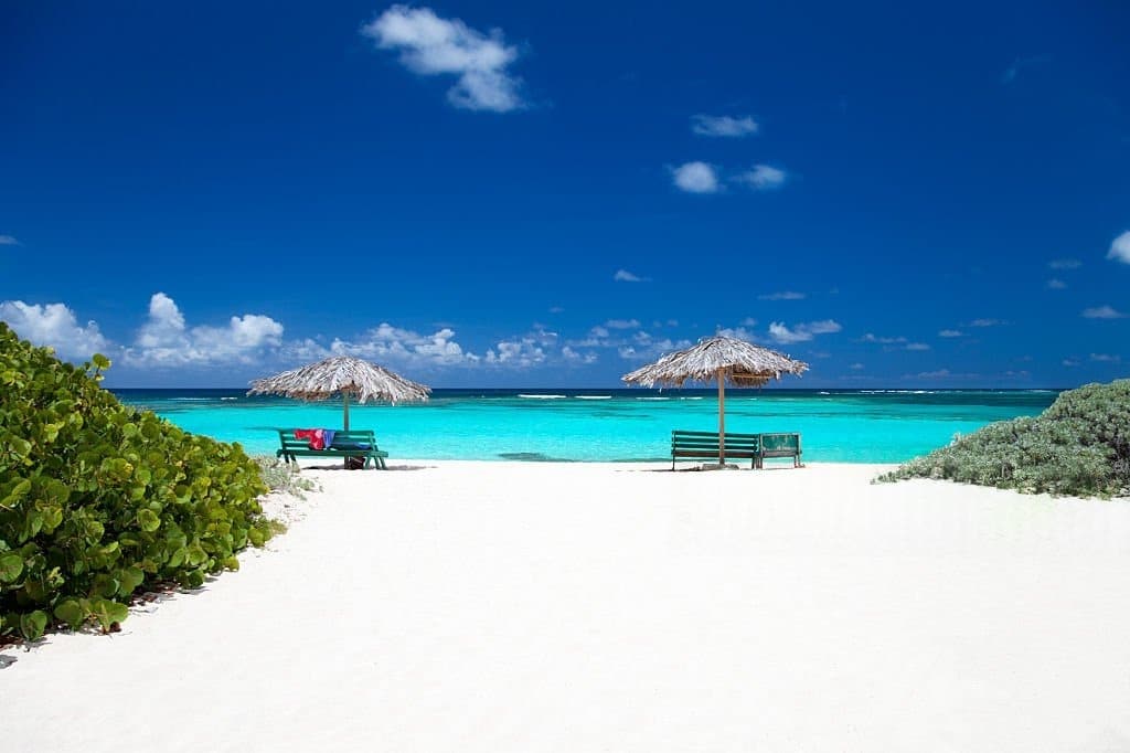
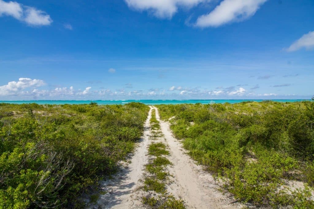
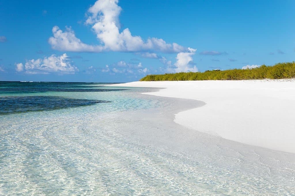
Here, you don’t look up at the hills. It glides towards beaches, salt ponds, shallows and passes. This horizontality changes everything. It explains the caution of sailors, the place of the reef, the presence of birds, but also the way tourism has developed: less around spectacular scenery than around a fragile natural balance.
18 miles of reefs, between refuge and danger
Horseshoe Reef is the number that gives thickness to Anegada. This barrier reef measures around 29 kilometers, or 18 miles. It is billed by the BVI government as the largest barrier reef in the Caribbean, and the fourth largest in the world. For an island that doesn’t exceed 28 feet, this coral belt functions as a living rampart.
But this rampart also has a dark memory. The reef has long made maritime approaches difficult. Inaccurate charts, shallow waters and coral formations have trapped many a ship. The HMS Astraea in 1808, the Donna Paula in 1819 and the MS Rocus in 1929 are among the wrecks cited in local history. Anegada is a reminder of a simple truth: the maritime beauty of the Caribbean has often been inextricably linked with risk.

A rare geological difference in the archipelago
Anegada’s strength also lies in its composition. It is the only coral island in the Virgin Islands volcanic chain. Made of coral and limestone, it stands out clearly from its neighbors. This geological detail explains its almost flat relief, long white beaches, underwater caves, clear springs and salt ponds.
This difference avoids the cliché of the interchangeable island. Anegada doesn’t sell the same imaginary world as the other territories of the BVI. It tells of a lower, more exposed Caribbean, more attentive to invisible thresholds: depth, navigation, reef protection, access to natural areas. And this is precisely where RK Facts finds its value: a figure opens up a complete understanding of the territory.


Flamingos, salt ponds and tourism responsibility
To the west of the island, the salt ponds add another dimension. They have long been home to Caribbean flamingos. Authorities report that these birds were present in their thousands in the 1830s, before disappearing locally around 1950 as a result of hunting for food and feathers. Their reintroduction today gives Anegada a strong ecological significance.
The island is not just a place of beaches and reefs. It raises a question of management: how to receive visitors without damaging what makes the place so unique? In fact, the government states that anchoring is forbidden on Horseshoe Reef in order to protect the reef. This detail lends depth to the subject: Anegada attracts visitors because it remains fragile.
At 28 feet high and 18 miles of reef, Anegada turns two numbers into a Caribbean lesson. The island doesn’t dominate the sea; it negotiates with it. And in this tension, it reminds us that a territory can be immense in its vulnerability, its memory and its way of standing up to the water, all year round.


Anegada is located in the British Virgin Islands, in the northeast of the archipelago. It stands out from its neighbors for its low relief and coral formation. Unlike many of the BVI’s more mountainous and volcanic islands, Anegada is a flat island of coral and limestone. It’s this geographical singularity that makes its landscape so special.
Anegada is known for its maximum height of 28 feet, or around 8.5 meters above sea level. This figure tells us a lot more than just a relief: it explains its name, its direct relationship with the sea, its environmental fragility and its identity in the British Virgin Islands. Anegada impresses not with its mountains, but with its constant proximity to the water.
Horseshoe Reef is essential to understanding Anegada. This reef stretches for some 18 miles around the island, and plays a role of natural protection, marine heritage and maritime memory. It has contributed to the ecological richness of the area, but it has also made navigation difficult for a long time, with several shipwrecks recorded in local history. This is one of the elements that gives Anegada its narrative power.