



Martinique has just won a 2026 Silver Magellan Award for its culinary heritage. Presented by Travel Weekly, this award honors the Martinique Tourism Board in the category of Caribbean culinary destinations. This international recognition highlights the island’s flavors, its culinary expertise, and a growing ambition: to make Martinican cuisine a true travel experience. 2026 Silver Magellan Award: An Accolade for Martinican Cuisine The results of the 2026 Travel Weekly Magellan Awards are now available on the competition’s official website. Martinique is among the winners, having received a silver medal in the “Caribbean – Overall Destinations – Culinary Destination” category. The Martinique Tourism Committee’s (CMT) entry, titled “Martinique: Where Culinary Heritage Comes to Life,” highlights a destination where culinary heritage continues to thrive and be passed down through the generations. Organized by the U.S. trade publication Travel Weekly, the Magellan Awards recognize achievements in various areas of international tourism. Entries are
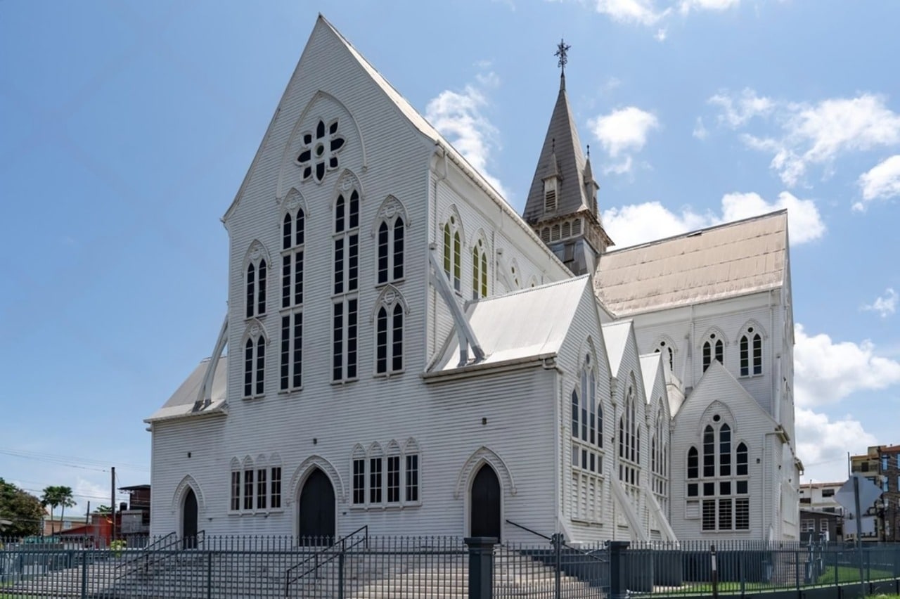
St. George’s Cathedral in Georgetown, Guyana, is approximately 43.5 meters tall and is built of wood. Consecrated on November 8, 1894, it replaced a brick cathedral, completed in 1842, whose tower was deemed too heavy for its foundations. Its history is that of a building made of greenheart, a hardwood native to Guyana, which the diocese must continue to protect. In January 2015, Dean Paul Andrew Carto, rector of St. George’s Cathedral in Georgetown, Guyana, warned that the building’s problems would not be solved by barbecues and bake sales. That statement sums up the challenge facing this landmark. In Georgetown, St. George’s Anglican Church is a large, 43.5-meter-tall wooden structure, and wood requires constant maintenance. St. George’s Cathedral, a 43.5-meter-tall wooden structure in Georgetown St. George’s Cathedral in Georgetown, the capital of Guyana, stands on Church Street and is approximately 43.5 meters, or 143 feet, tall. The UNESCO Tentative List
We’ve reached the halfway point of the series “Stories of Caribbean Cinema.” The first four episodes have spanned nearly three decades of cinema, from Cuba in the 1960s to productions from Martinique and Curaçao in the 1980s. This fifth installment moves into the 1990s with two films set in very different worlds. Euzhan Palcy’s *Siméon* delves into a Caribbean imagination where music, ghosts, and magical realism converge. Raoul Peck’s *The Man on the Quay* revisits François Duvalier’s dictatorship in Haiti through the eyes of a child. You are now reading the fifth episode in a series of ten. Four episodes have already been published on Richès Karayib, and five more will follow in this series through 2025. 1997: JAMAICA – “DANCEHALL QUEEN” BY RICK ELGOOD & DON LETTS Dancehall Queen is one of many Jamaican films that follow the formula established by *The Harder They Come* (Perry Henzell, 1972): Jamaican