


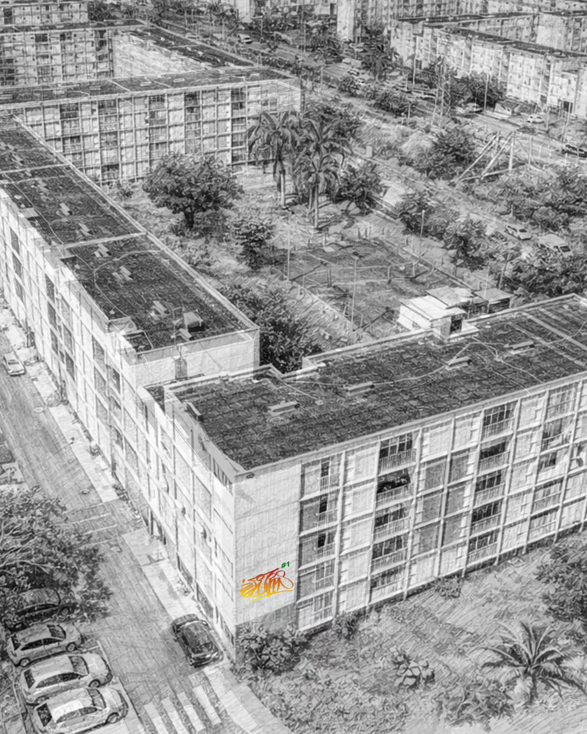
From May 9 to 17, 2026, the Raizet district of Les Abymes will play host to WAL FEST 2026, billed as Guadeloupe’s first major urban art festival. For ten days, 15 artists from Guadeloupe and elsewhere will create 12 monumental frescoes. The aim is clear: to turn the neighborhood into a free, permanent, open-air museum. The Abymes district at the heart of the project In Raizet, the walls of the Les Esses 1, 2 and 3 residences and of Quartiers 1 and 2 of the SIG will be more than just supports. They will become the visible heart of a cultural project designed in collaboration with residents, neighborhood associations and the Raizet socio-cultural center. WAL FEST 2026 is not just about showing finished works. It wants to make visible the artistic gesture, the live work, the exchanges, the hesitations and the encounters. Co-organized by the WAL association, Wad Al Lub,
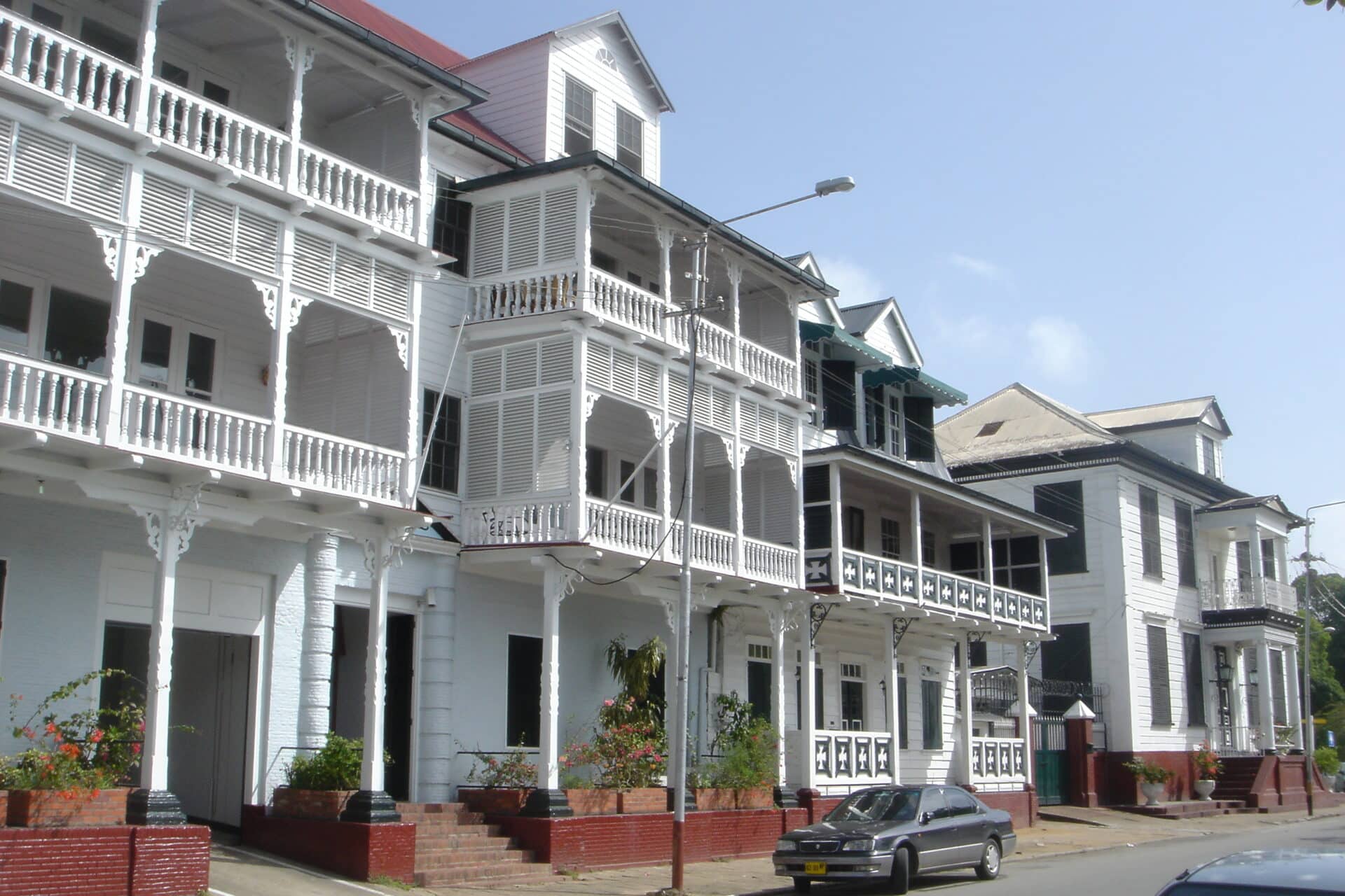
When you arrive from the Suriname River, it’s not a concrete silhouette that takes shape, but a succession of white plank buildings, lined up for over three centuries. Paramaribo doesn’t have the allure of other South American capitals. It took a strange gamble: to remain made of wood. And it has kept its promise, despite fires, humidity and urban pressures. A historic center recognized by UNESCO since 2002 Traced back to 1683, it’s one of the few colonial cities in America whose historic center is still mainly built of wood. Where other capitals have replaced their colonial houses with stone or concrete buildings, Paramaribo has preserved its original street layout and much of its ancient built fabric. This persistence earned Paramaribo its inscription on UNESCO’s World Heritage List on June 29, 2002, on the basis of cultural criteria ii and iv. The fusion of Dutch architecture, European techniques, South American

The 2025-2026 cruise season in Martinique has come to a close on a strong note, with 568,348 passengers announced and a clear increase in patronage over the previous season. In a region where tourism relies as much on hospitality as on the quality of experiences offered ashore, these results reflect the destination’s growing presence on Caribbean itineraries. They also show that Fort-de-France, Saint-Pierre and the local players are moving in the same direction: better welcome, better orientation and better promotion of Martinique’s heritage. Two long-awaited final stops in Fort-de-France The 2025-2026 cruise season will close on Friday, April 24, 2026 with two calls to Fort-de-France. RCCL’s ship is expected to call at the Tourelles terminal with around 2,000 passengers, while Princess Cruises’ Caribbean Princess is scheduled to call at the Pointe Simon terminal with around 3,500 passengers. Most of the cruise passengers are expected to be American, between 7 a.m.