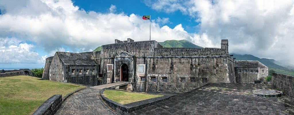
To the northwest of Saint Kitts, the walls of Brimstone Hill Fortress overlook the coast from a volcanic hill nearly 240 meters high. Behind the panoramic view lies a more complex history: that of a fortress designed by the British, built and maintained by enslaved Africans, and designated a UNESCO World Heritage Site in 1999.
Brimstone Hill Fortress, a citadel perched atop a volcano
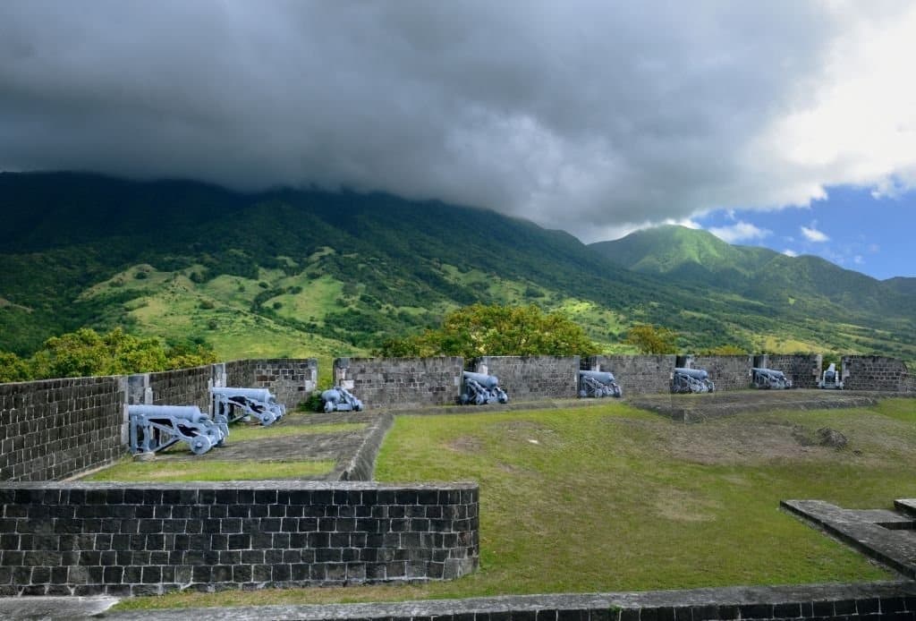
As you climb Brimstone Hill, the sea comes into view between the steep slopes and the dark stone ramparts. From this natural vantage point, soldiers could observe the western coast of Saint Kitts and keep watch for the possible arrival of enemy ships. The location was far from insignificant. This volcanic hill, nearly 800 feet high, had steep, hard-to-access slopes. It thus offered a prime vantage point and a defensive refuge in the event of a naval attack. Nevertheless, the builders had to adapt their techniques to the particularly challenging terrain.
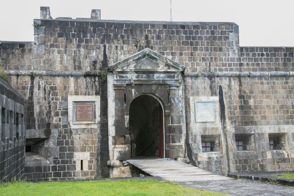
The walls were built primarily from volcanic rock quarried from the hill. The mortar was made on site from limestone found on the hill’s middle and lower slopes. The fortress thus seems to be an extension of the landscape on which it stands.
1690: The Start of a Project That Would Last More Than a Century
The construction of Brimstone Hill Fortress began in 1690. That year, the British set up cannons on the hilltop in order to recapture Fort Charles from the French. The site was then gradually expanded, in successive phases, until the 1790s. This construction project, spanning more than a century, attests to the strategic importance of Saint-Christophe, now known as Saint Kitts. The English and French established a permanent presence on the island in the 17th century and shared control of it between 1627 and 1713. Saint Kitts thus became one of the first footholds for their colonial ambitions in the region.
At that time, the Caribbean territories were generating considerable wealth for the European powers. The ports, plantations, and shipping routes had to be protected. Given its scale, Brimstone Hill was a testament both to British military power and to the economic value placed on the island.
British architecture, a project imposed on Africans
The fortress’s architecture met the requirements of British military engineers. Yet the people who transported the materials, quarried the rock, and built the walls were primarily enslaved Africans. This reality lies at the heart of the historical value recognized by UNESCO. Brimstone Hill Fortress It is not only a remarkable example of 17th- and 18th-century military architecture; it also bears witness to European colonial expansion, the transatlantic slave trade, and the emergence of new societies in the Caribbean.
To present the site as merely a British feat would therefore overlook an essential part of its history. Its architecture is also the result of the strength, skill, and endurance of enslaved workers, who were subjected to particularly harsh conditions on the steep slopes.

Fort George, the defensive heart of the fortress
At the summit stands Fort George, the monumental heart of the complex. Built on one of the two highest points, it comprised barracks, storage areas, artillery positions, and spaces arranged around a central courtyard. Fort George is one of the oldest surviving British examples of a so-called “polygonal” fortification system. Unlike forts dominated by large, projecting bastions, this design better conformed to the terrain and provided multiple defensive angles. Several restored rooms now house a museum dedicated to the site’s history.
A large cistern built beneath one of the rooms was used to collect and store water. According to the ICOMOS assessment, it was still being used as the park’s main water source at the time of the UNESCO nomination review.

From Military Use to World Heritage Site
After several generations of occupation, British troops left the fortress in 1853. The complex gradually lost its military function, and several buildings fell into ruin. A restoration movement took shape in the 20th century. The Society for the Restoration of Brimstone Hill was founded in 1965. Now known as the Brimstone Hill Fortress National Park Society, it manages the park on behalf of the government and the people of Saint Kitts and Nevis.
In 1999, UNESCO inscribed the site on the World Heritage List under criteria III and IV. The protected area covers 15.37 hectares and remains one of the best-preserved historic fortified complexes in the Americas.

Brimstone Hill Fortress: A Memory to Face Head-On
From the ramparts, the landscape can make you forget, for a moment, the violence of history. Yet every wall serves as a reminder of colonial conflicts, rivalry between empires, and the forced labor that made the site’s construction possible. Preserve Brimstone Hill Fortress…it means preserving much more than just a former military outpost. It means passing on a heritage that showcases, all at once, the architectural ingenuity, the European ambitions, and the experiences of the Africans who built the fortress. This leaves one crucial question: How can we admire such a monument without separating its beauty from the lives sacrificed to build it?
Brimstone Hill Fortress is located in the northwest of the island of Saint Kitts, in the country of Saint Kitts and Nevis. The fortress overlooks the coast from a steep volcanic hill.
Brimstone Hill Fortress has been a UNESCO World Heritage Site since 1999. The site is recognized for its remarkable British military architecture and for its role in documenting colonization, the transatlantic slave trade, and the labor of enslaved Africans.
Brimstone Hill Fortress was designed by British military engineers. Its construction and maintenance relied primarily on forced labor provided by enslaved Africans between the late 17th century and the 18th century.